We Round Out Another Adventure (however short!)

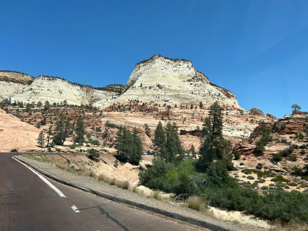
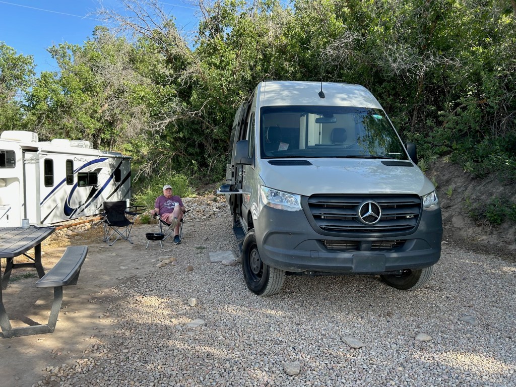
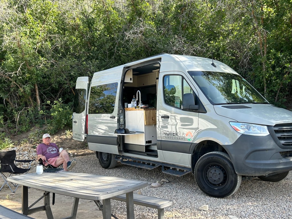
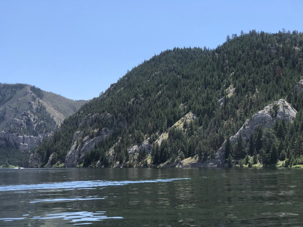
We made our way to Moab from Torrey experiencing continued issues with low tire pressure on the right rear tire. We have been fighting/ignoring it since we were 5 miles from the Moterra facility in North Salt Lake City.

The route took us through the ranges of cattle (and who knows what else) and there was no sign of life or cell phone service anywhere. Thankfully, we made it to civilization without issue and called the company for assistance. Tyler, one of the owners, took on our plight — with only minor “encouragement” from the Admiral. As it was a Saturday morning (everything closed for the weekend), we elected to continue to Moab as by then we were 45 miles away. The rest of that story will be found later, so wait for it!

We were advised by Mel early that morning that there was no reason to rush to Moab. They had arrived late Friday night after a flight from Los Angeles to Salt Lake City and then a 4 hour drive to Moab, only to be met with an unpleasant experience with their late check-in the night before into a pre-arranged cabin. Finally, they took refuge at 3:00a at the local Holiday Inn Express, where an angel was there to greet them.

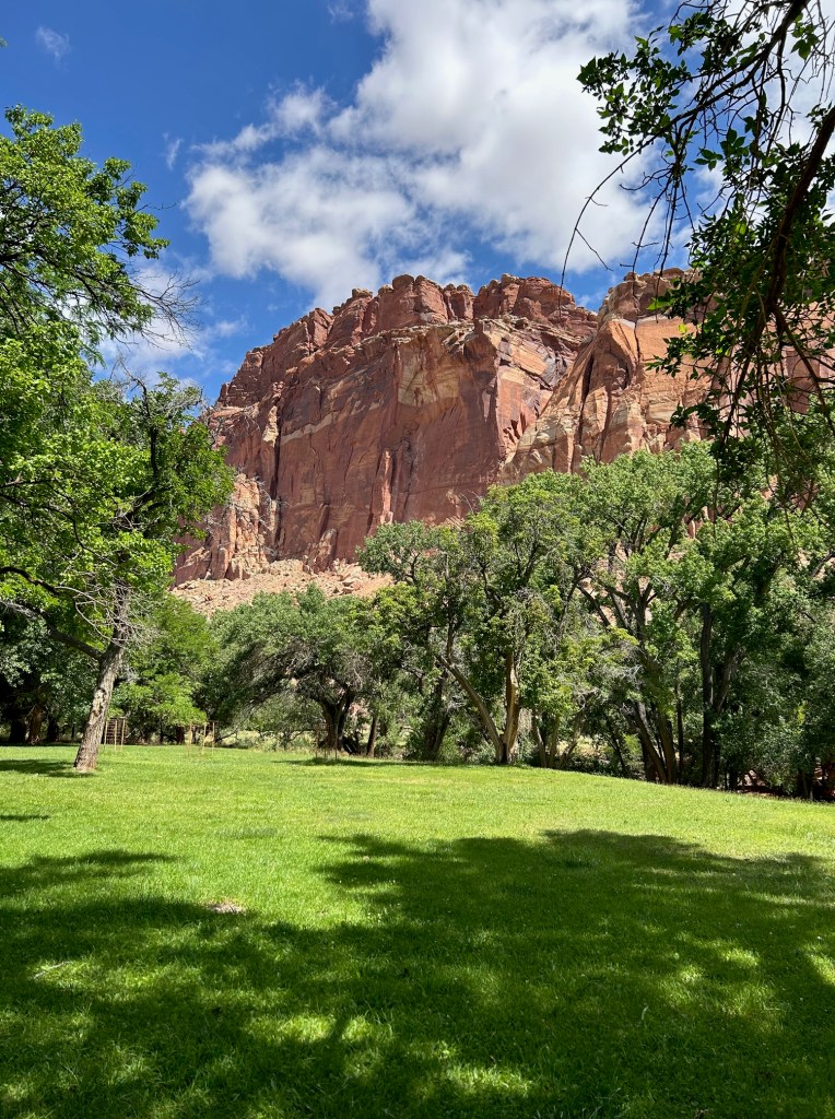
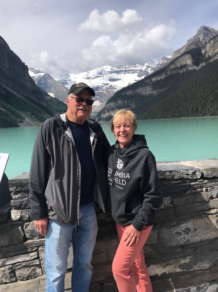
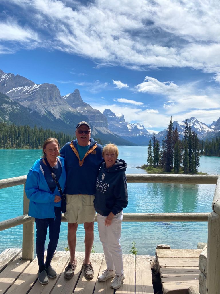
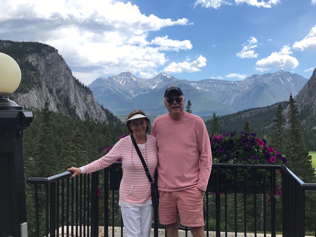
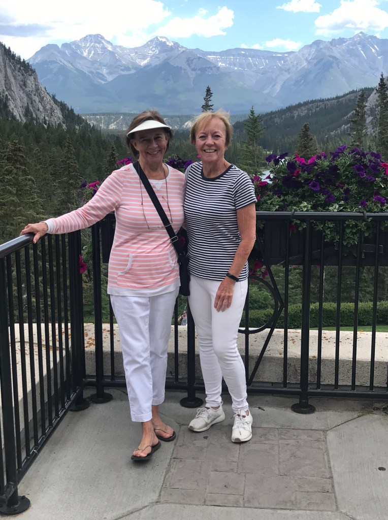
We arrived just as they did from the hotel, having straightened out the problem – and we arranged to have the van just steps away from their little “home away from home.” Now, you might think a <200 ft2 cabin would not be referred to as “home” – it at least had air conditioning and a flush toilet as well as a good shower. We celebrated our reunion, as it had been a year since we were together – in Charleston for several fabulous days of Spoleto. Out came the Prosecco – let the party begin! We wrapped up the celebration that evening with homemade pie ala mode – pies courtesy of the Mormon Village recreation at Capitol Reef.

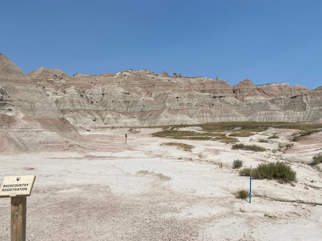
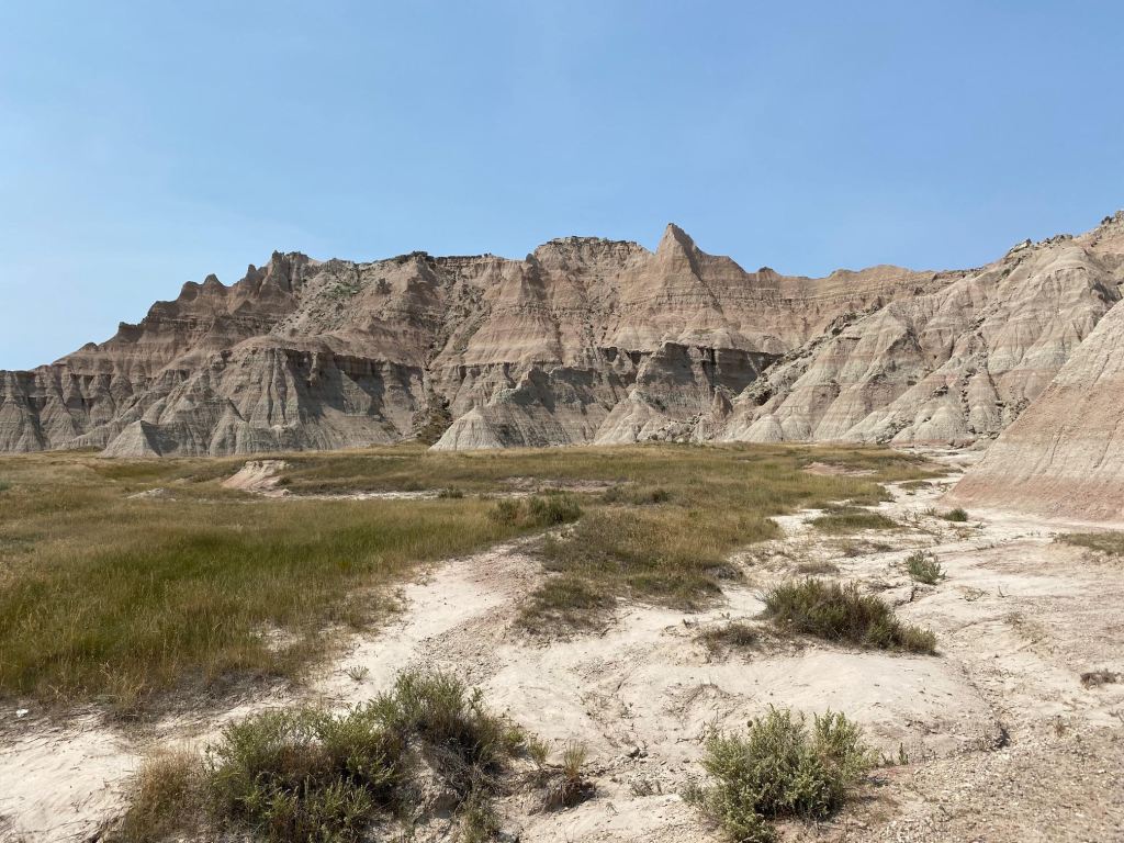
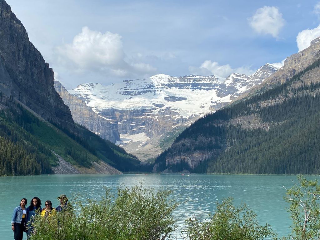
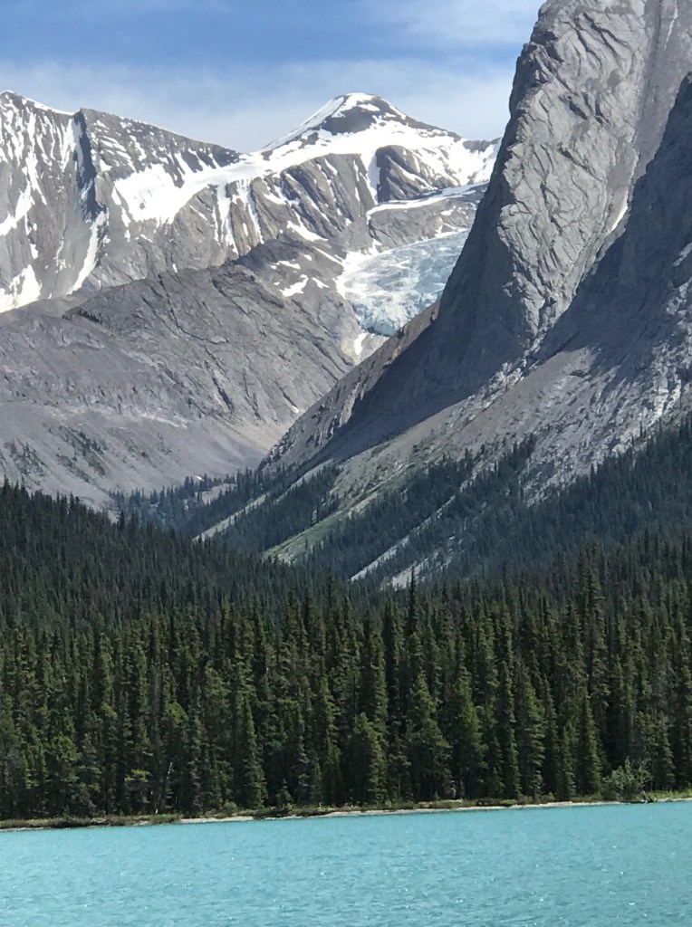
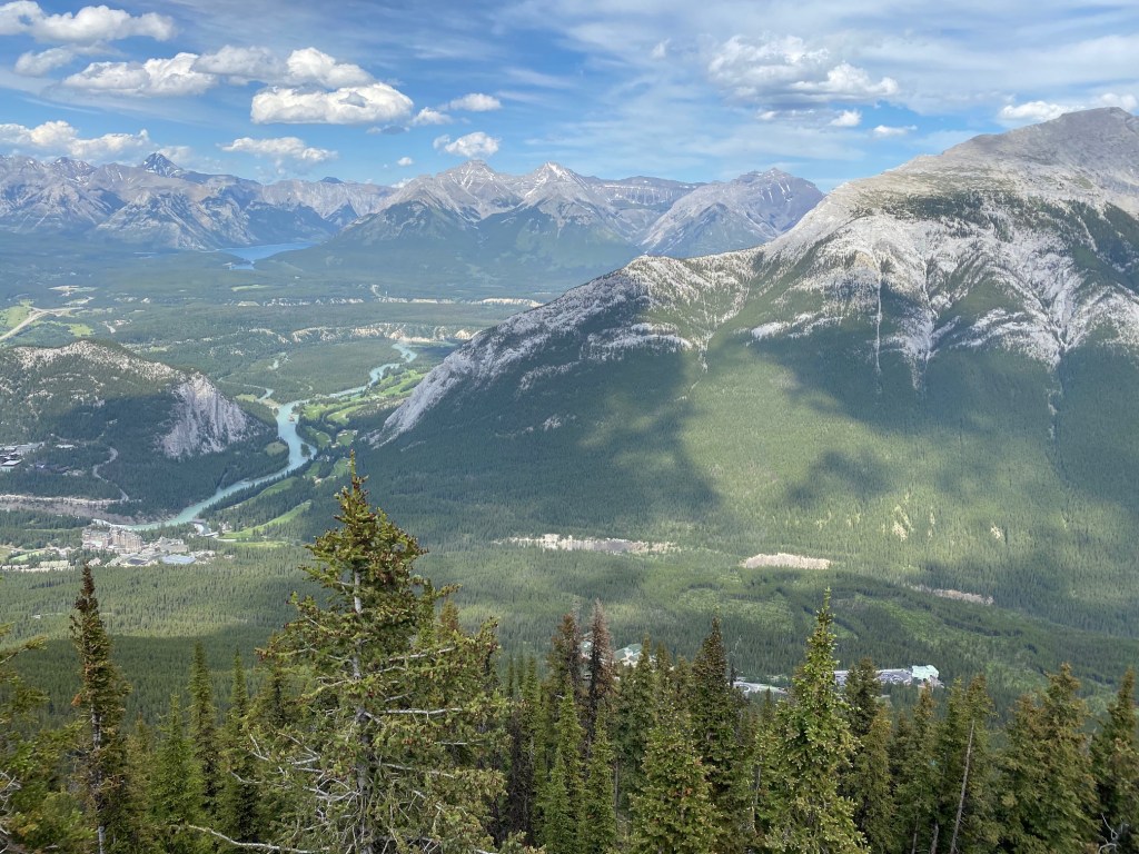
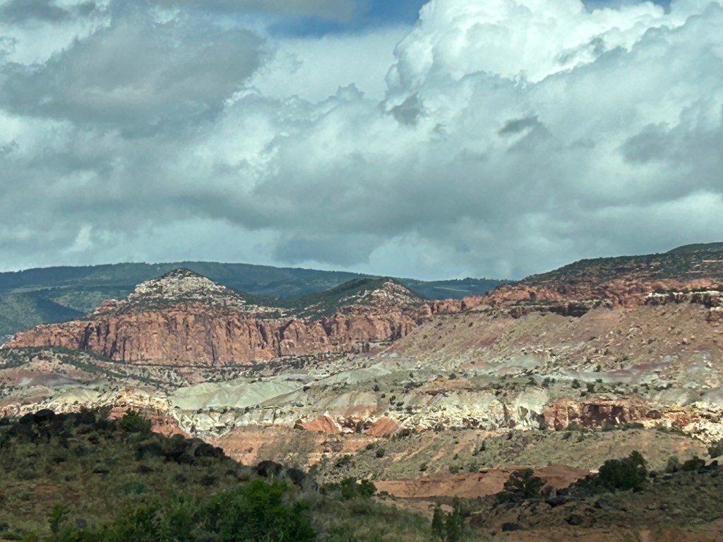
To mitigate both the heat and the crowds, we had a timed entry permit at Arches National Park the following morning for 7:00a. The entrance to the park was less than 2 miles from our campground, so it was an easy launch site. And what a glorious explosion of amazing rock formations were awaiting us!

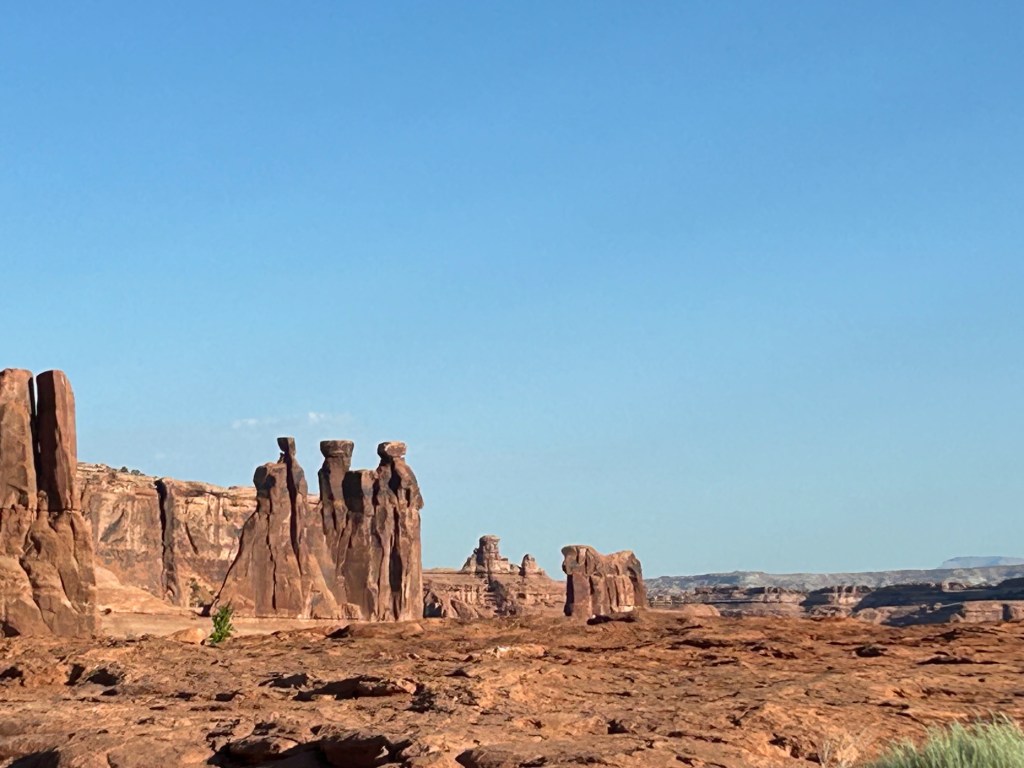
Many of the “sculptures” are called “fins” that take on a personality. On the left is “The Gossips” and “The Sheep”. On the right is “The Gossips” closer.

Captain Bill was bucking up well under the challenges of bronchitis (lingering for its 4th week) and side effects of new blood pressure medicine – one of which was extremely swollen ankles. So, our hiking was limited to short walks rather than longer hikes. As well, the daily temperature by 10am was well into the 900F’s and by mid-afternoon cresting over 100oF, so exhaustion and dehydration were also of great concern.

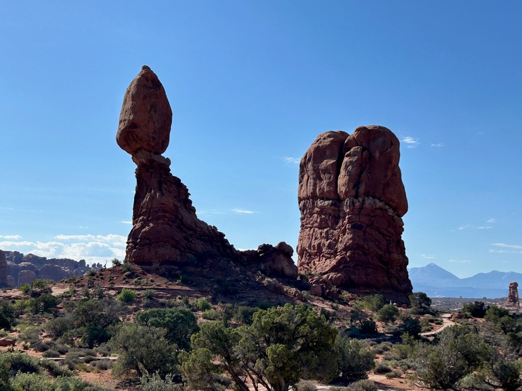
Known as the “Balance Rock”, these types of structures can be found throughout the park. The story goes that a gentleman did not believe the Park Director’s assurance that the rock was not supported by concrete. So, he decided to climb the rock to inspect it. Of course, he got up there and – sure enough – no concrete but no way to get back down and had to be rescued.

We had purchased a product from “GuideAlong” which is an amazing, GPS-driven app that takes you through all the areas of the park. We thoroughly enjoyed the narrative and education.

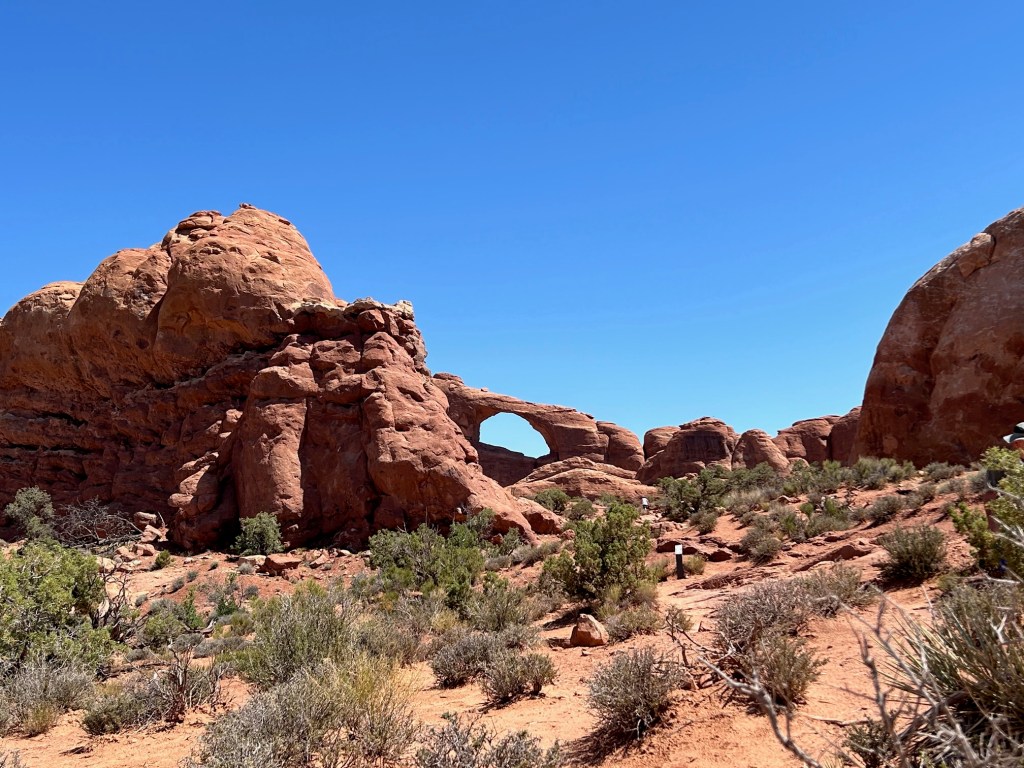
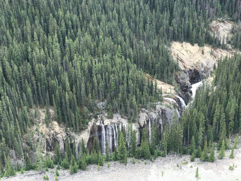
There are some 250 arches in the park.

We departed Arches about 1p, and made our way to Spokes for a lovely lunch, a stroll about town for a bit and then a pay-off to the boys with some ice cream. Then back to the campground where Mel & Yvonne found a refuge in their cabin and the Captain & Admiral made a beeline for the pool!

On Monday, we elected to postpone the resolution on the low tire for another day so that we could make our way to Canyonlands early, as that proved to be a highly successful approach. Our friends were so gracious to do all the driving in their rental car rather than utilizing the van, which was more comfortable in so many ways.

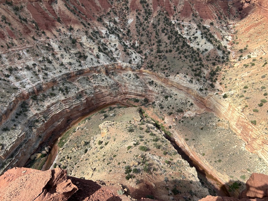
Canyonlands can be accessed through three different entry points, each many miles apart and providing access to three very different aspects of the park. Being in Moab, we did the “Island in the Sky” section of the park – the entrance was about 40 miles from our site in Moab.
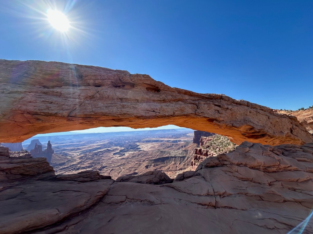
Mesa Arch

We did the 1 mile roundtrip hike to the Mesa Arch, as it is such a unique but recognizable feature of Canyonlands. Our guide (on GuideAlong) said that many mornings, there will be several photographers vying for the “perfect shot” as the sun rises through the Arch.

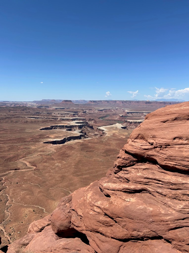
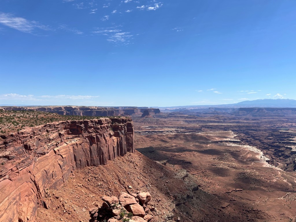
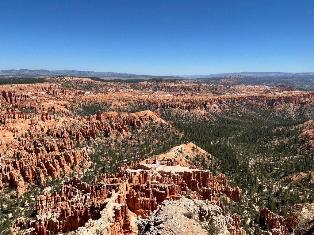
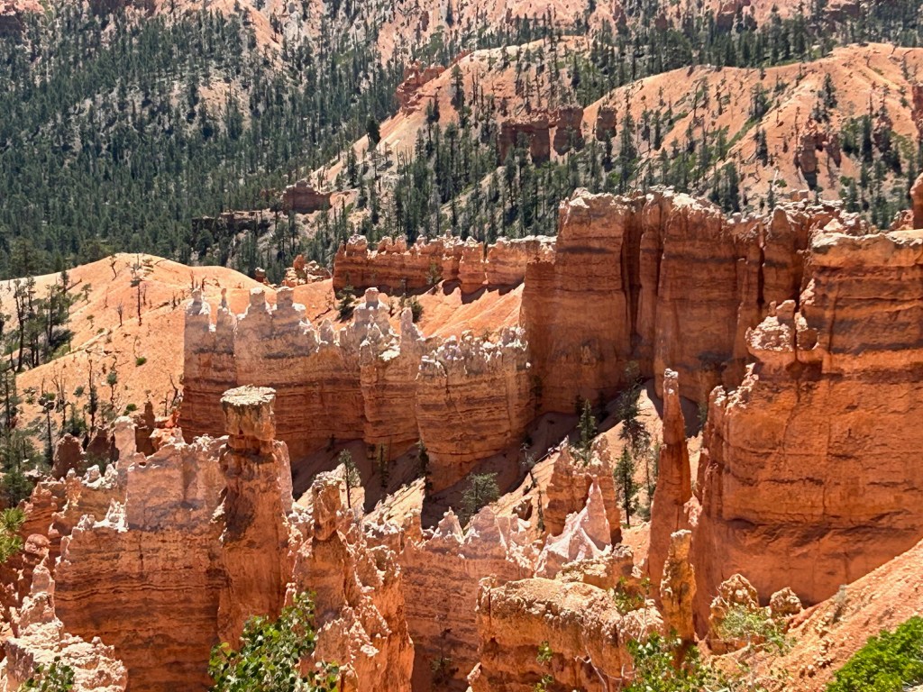
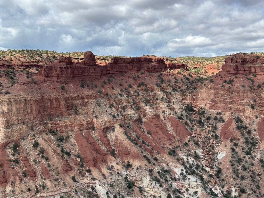
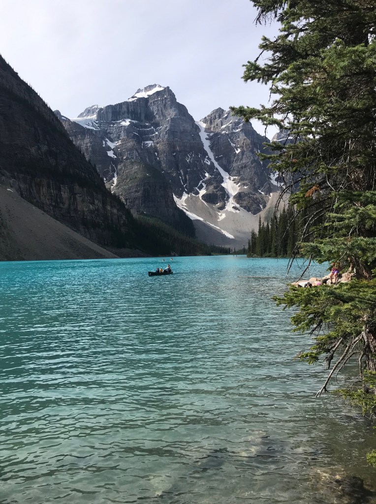
The vistas of Canyonland

The Grand View was simply that – Grand! And augmented by a delightful Park Ranger from Pittsburgh who gave an interesting 20 minute talk on the geology and timing of the most recent 275 million years.

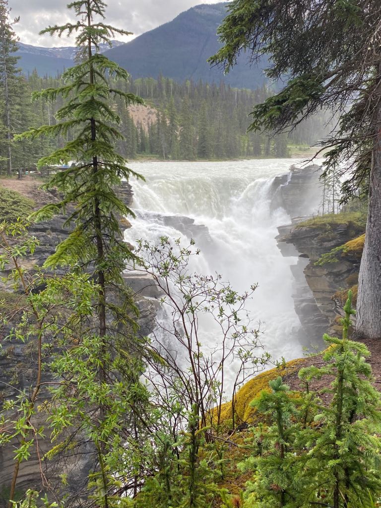
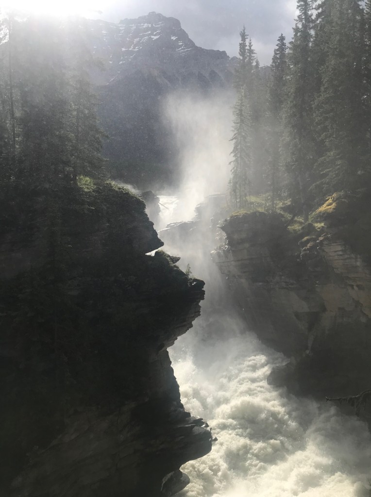
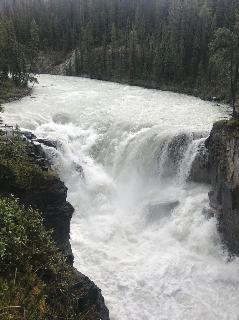
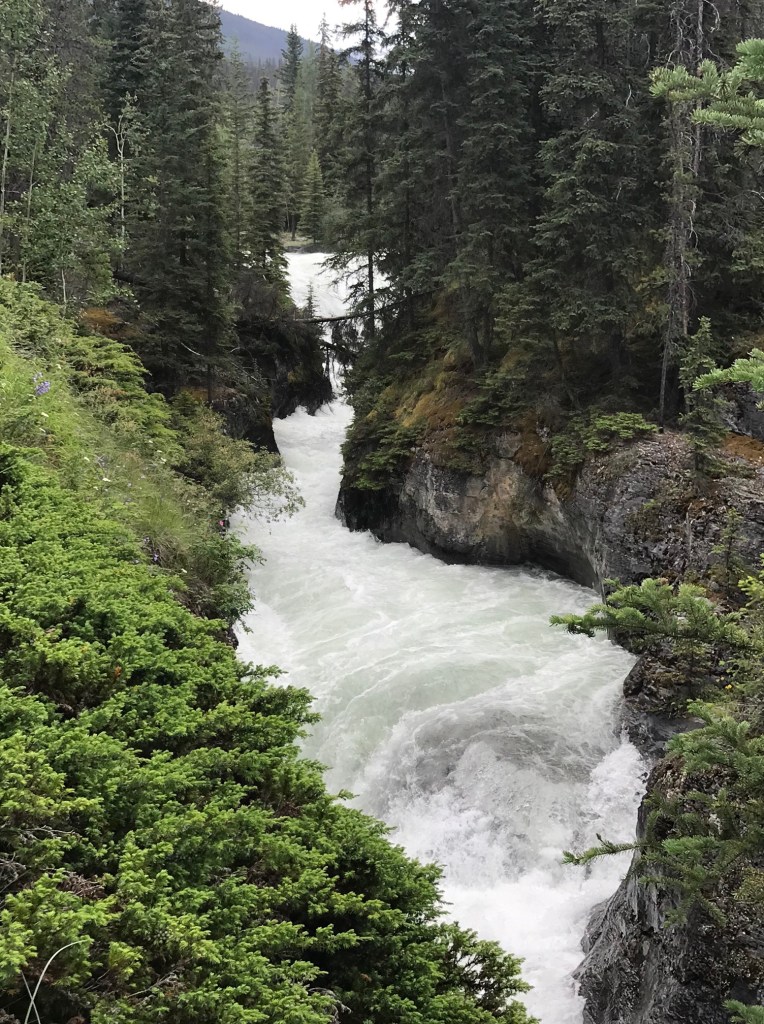
The Colorado River (on the left) can be seen in the distance, the architect of this amazing canyon. On the right is a beautiful cut of the “upper layer” of the canyon made of Navajo Sandstone – it’s only ~135M years old!

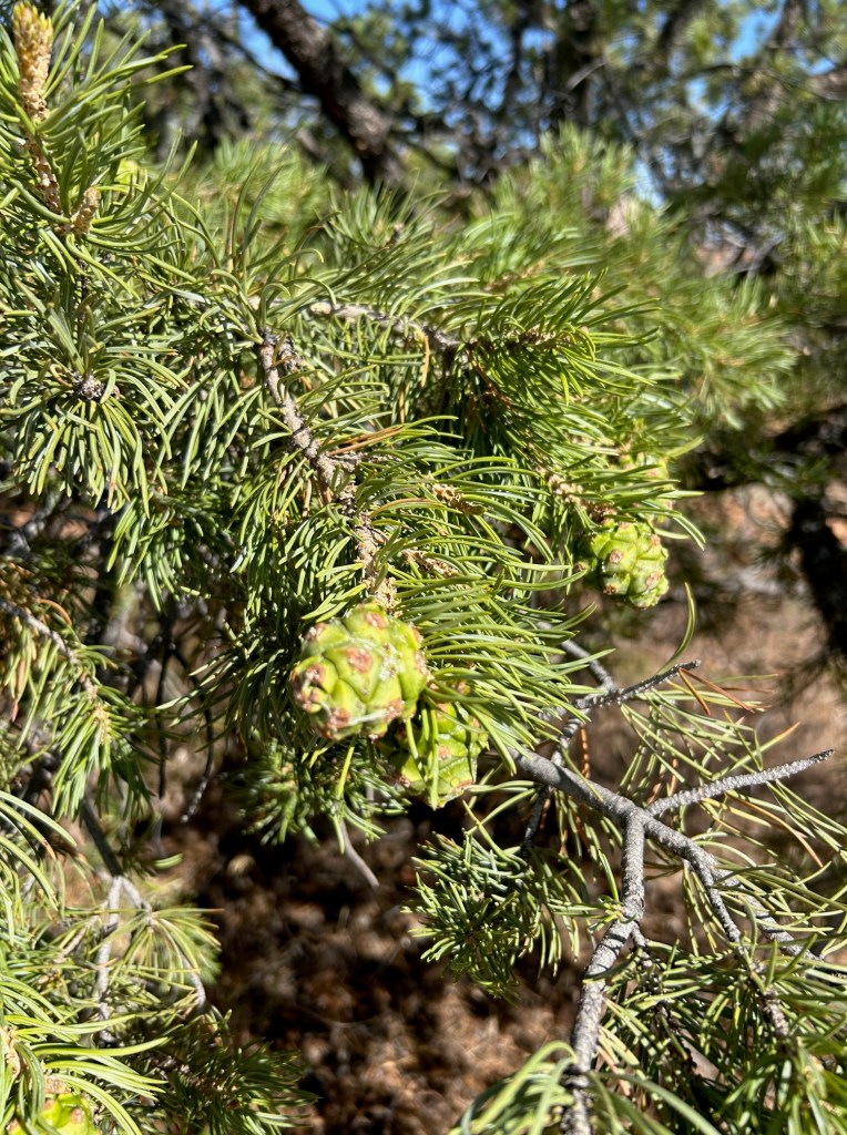
Canyonland benefits from precipitation and ground water sources, so Pinyon Pines and Utah Juniper are quite prolific. The juniper on the left is full of juniper berries – the key ingredient for flavoring gin. Mel & Yvonne, with her fondness for gin, savored a bit of shade from a very handsome juniper tree. The far right picture is a pinyon pine complete with pine cones – the source for pine nuts.

Again, we returned to Moab about 1p and this time made our way to the Moab Diner, which was a rich delight. And, we could do this guilt-free as the ranger implored us to drink lots of fluids, but also to consume more calories and more salt than “normal”, as your body burns more calories at higher altitudes. We respectfully obliged!

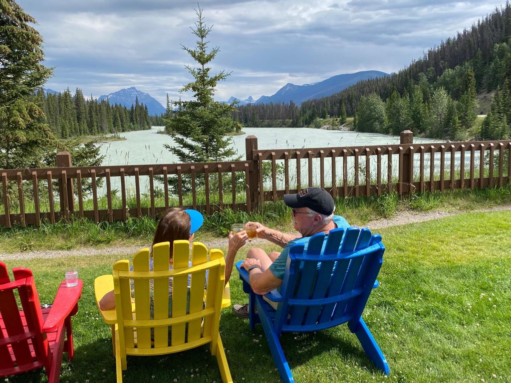
Yvonne, the Captain & the Admiral retreated to the pool for the afternoon, until a thunderstorm rolled in which forced them to close the pool. We were thankful as we barely got back to the van/cabin when the downpour arrived. We got things put away and hunkered down, enjoying the sounds and the cooling of the air. The coolness only lasts as long as it is raining, for as soon as the storm clouds cleared – it was back to 102oF.

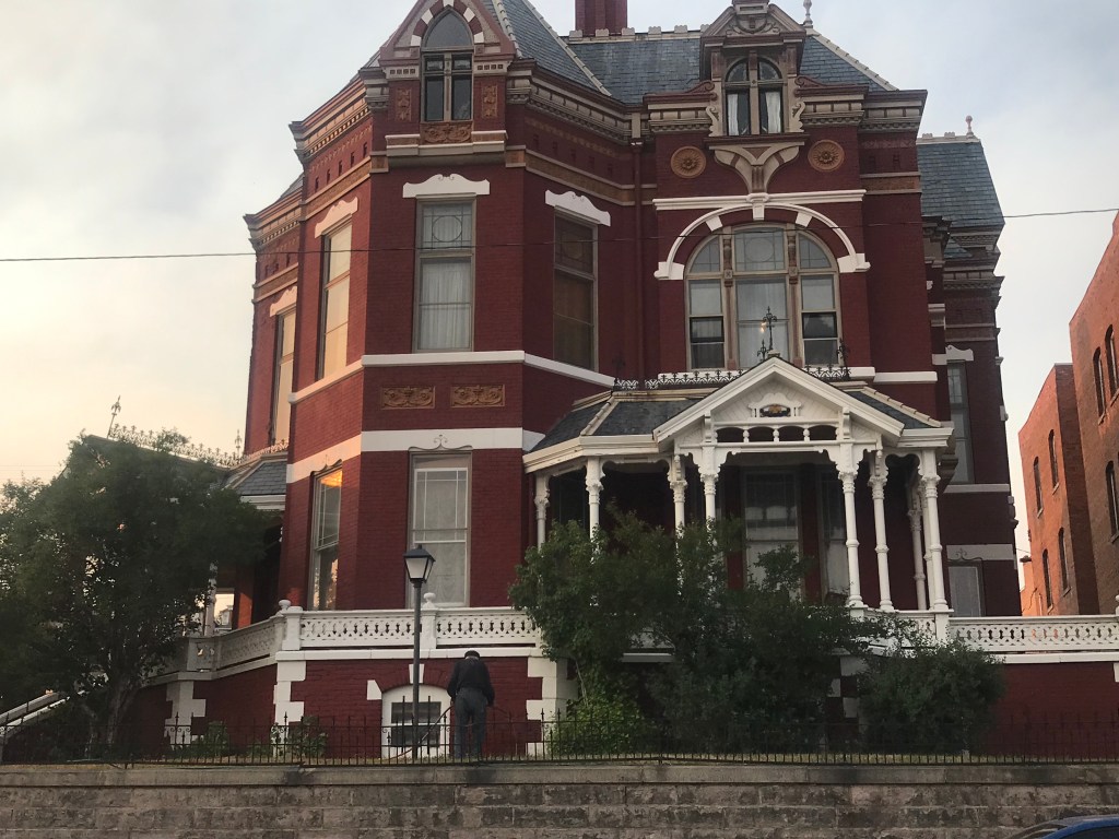
Our last evening together for this visit was truly memorable. We had seen the Sunset Grill upon our arrival in Moab, as it sits well above the city overlooking the valley and mountains on the other side.

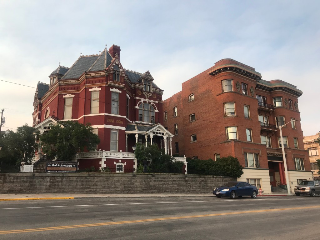
The restaurant is in the former home of Charlie Steen, a geologist from Texas who headed west in 1949 in search of uranium. The 1946 Atomic Energy Commission had issued $10,000 incentives for domestic uranium discoveries. With 3 small boys and another on the way, Charlie & Minnie Lee (on a $100 loan from his mother) tried Colorado before moving on to Utah. Many failed attempts and a literally starving family, Charlie & family set off for Tucson AZ and Charlie worked as a carpenter to support his family. The “bug” to strike it rich, however, never left him and they returned to Utah about year later.

With limited resources, he did not have the proper equipment to prospect or test properly and his “last attempt” failed when his drill bit broke some 176′ into the earth’s surface. He threw the equipment in the back of his truck and it wasn’t until days later that he encountered a friend at the local gasoline station, whose geiger counter went crazy when it got close to Charlie’s truck! He had struck uranium at only 70′ and the result was the largest uranium discovery during the uranium boom. It made Charlie an overnight multi-millionaire, some reports as high as $130,000,000 which was an incredible fortune in September, 1952!

He named the mine “Mi Vida” which is My Life, built his home overlooking the valley that had provided his fortune and proceeded to be a generous employer and philanthropist. Unfortunately, the run for uranium dwindled within a few years and, due to poor financial management, Charlie lost a major portion of his fortune. However, even when you lose a significant portion – when you start with $130M, there is still some there!

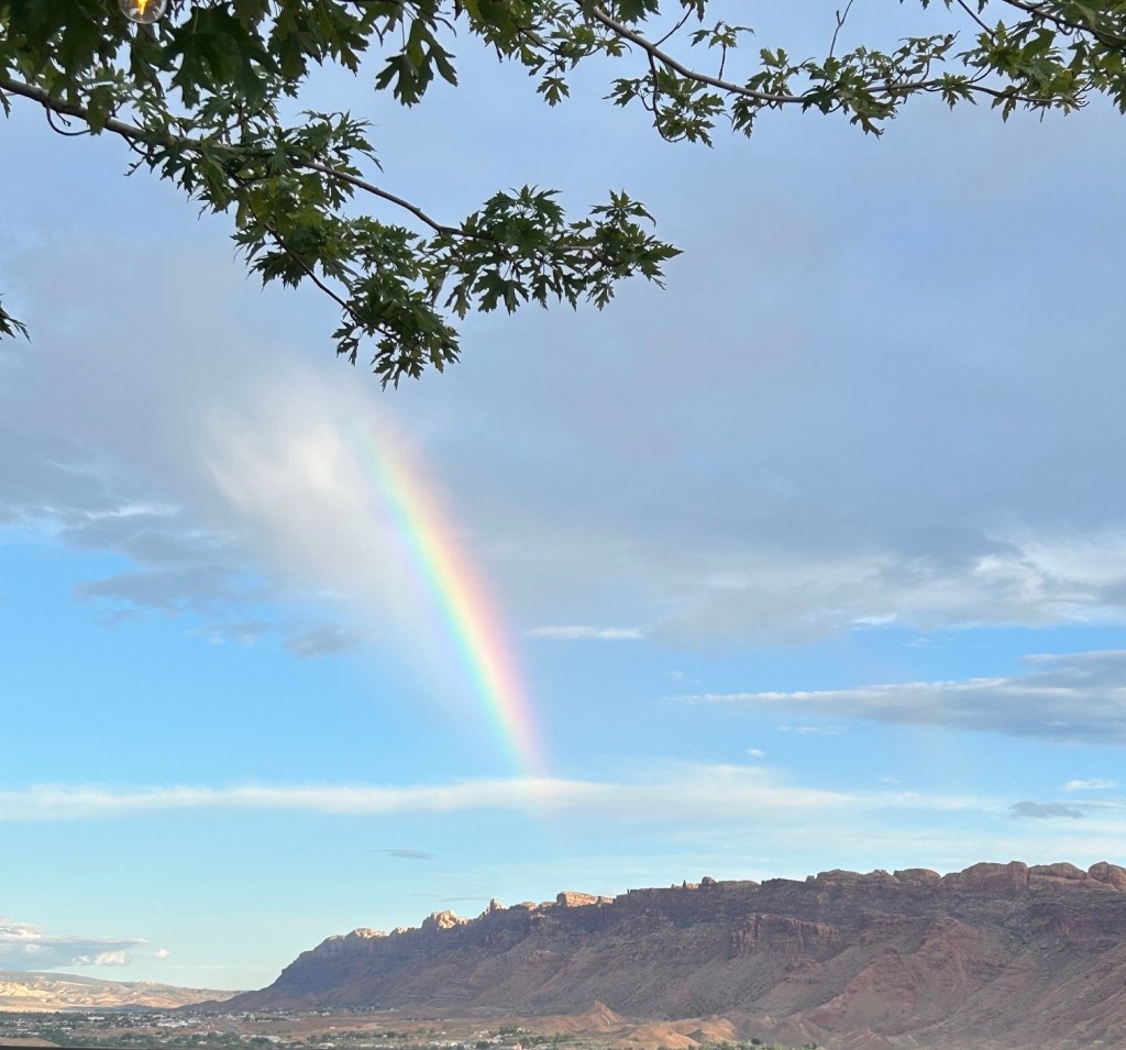
But, back to our dinner. We were seated under the shade of a large triangular covering on the grassy lawn, where a breeze helped cool us until the sun when down. We spent a relaxing evening over good food, refreshing drinks and lively discussion at the location for our next rendezvous. And then, amazingly, we were gifted with a beautiful rainbow!

Tuesday morning it was time to face the music with the low tire, so we loaded up the van and presented ourselves to Point S Tire Service at 7:40a as instructed by Tyler from Moterra. The expectation was that if we got there then, we could get right in and be taken care of quickly. Wrong – there were 5 in front of us! So, we left them the van, called Mel & Yvonne and we met at the Moab Grill for breakfast. We laughed and plotted the “next adventure” and then they were off to Salt Lake City for their return flight to Los Angeles.

We returned to the tire shop – and 2 1/2 hours later, they finally took the van into the shop for repair. Add another hour and we were driving out of the shop – only to have the low tire indicator come on again!! We did a quick U-turn and back we went – to be told that we needed to drive the car at 30 mph for 20 minutes and the light “should” reset. Now, we are not Doubting Thomas, but….

Regardless, we did as we were instructed to do – and lo and behold, it worked! We made our way to Helper Utah (about halfway back to Salt Lake City). We’ll return the van in the morning and wing our way home compliments of American Airlines.

It’s been a delightful two weeks with great memories and much learning (we won’t go into the details of the air travel home!) – as part of this whole adventure was “what does the Captain & Admiral want to do next?” So, stay tuned! Until then, know that we love each and every one of you!

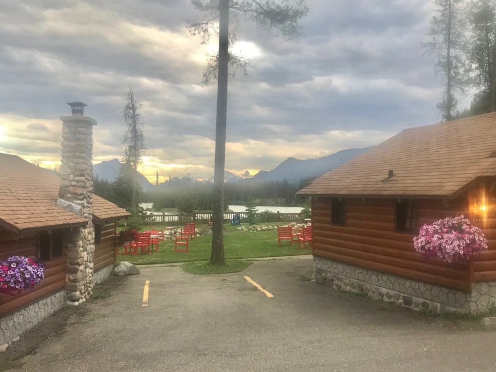
Sunrise on our last morning!
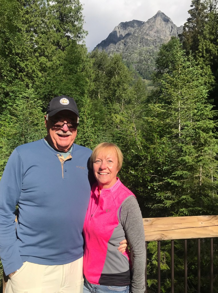
Much Love,

Captain Bill & Admiral Jann

The Captain & Admiral – On the Road Again!

A Reunion – and a Test Ride!

It is always a joy beyond measure to be with family! The bi-annual (usually but not always) Reunion of Ratts had been eagerly anticipated and superbly planned by Lisa Ratts Jennings Clark and ably assisted by Natalie Gardner Ratts. Everyone able to attend convened in Denver, in time to begin the festivities on Thursday evening.

The Captain & Admiral started out early for an easy trip from Asheville thru Charlotte to Denver compliments of American Airlines. And we do mean compliments as we continue to whittle away the frequent flyer mileage. That may seem unimaginable, as the Admiral has now been “retired” for over 13 years! However, you probably recall that the three things she never wanted to do again was – fly in an airplane, stay in a hotel and eat in a restaurant. We are glad to report that she has recovered from that statement, but years of boating and motor homing have limited air travel – at least on the airlines having frequent flyer balances.

We got to the airport shortly after 7:00a for a 9:05a departure – and thanks to a construction worker involved in the huge expansion of the Asheville Airport – we did not leave Asheville until almost 2:00p.  Destination Philadelphia, which if you have looked at a map recently, is directionally incorrect for Denver! A two-hour layover there put us into Denver at 10:00p local time, another hour to get out of the airport, stand in line at Avis while 40 people dealt with 2 agents, road construction on the airport exit roadway and a 45 minute drive to Elizabeth CO put us in about 2:00a local/4:00a body clock. Never fear – there were bleary-eyed Ratts (including niece & nephew) to greet us – but we all crashed shortly thereafter.

The weekend was a joyous blur of laughter, tears, hugs and lots of food & drink. There were Ratts we had not seen in a long time – and Ratts we had never met – and loads of Ratts that we love to see at every/many reunions. We savored the time and made plans to reunite over Fathers’ Day 2026 somewhere in Western NC! With a heads-up that 2028 needs to be in Cancun!

Top left – The Ratts Clan present, The Blood Ratts, Eric & Tricia & Family – and The Ratts Rock travels to the next destination – next will be #15!

We set out at 6:00a Sunday morning (long before anyone else was stirring) heading for Salt Lake City to begin our research into the Next Chapter of Travel. It was a long but uneventful day culminating in returning the rental car at the airport and preparing for our Uber early the next morning to pick up the 19’ Sprinter Van for our camping adventure to The Mighty Five National Parks of Southern Utah.

We arrived at Moterra Campervans – setting out early for our 10:00a pick-up to avoid any problems. First, GPS took the Uber to the wrong address, then upon arrival (9:20a), no one was there for our rendezvous. No problem – they are supposed to be open at 9a but running late!

We encountered a few surprises — as it is always the questions that you don’t ask that get ya every time. First, the literature touted an inside shower, but neglected to say there was nothing but a porta-potty! Second, there was no air conditioning – and we were headed to the desert of southern Utah which was under the “heat dome” of several weeks of extremely high temperatures. Third, there was no awning over the side door for living space (never seen a van that didn’t have one). Seems like we went to camping from glamping a bit more dramatically than we anticipated!

We checked out with Riley, twisted his arm to wash the windshield. He then gave us the rest of the bottle of Windex – as we know what bugs on a large front windshield do! We headed south, stopped for provisioning in Spanish Fork and arrived at Zion Family Campground by cocktail time. Spent the evening getting familiar with the rig – and realizing that without a grill or a microwave, our creative cooking was going to be curtailed (i.e., we’re camping!)

Fortunately, we had chosen to stay on the east side of Zion, which is more convenient to our next stop – Bryce Canyon. The elevation on the east side of Zion is 6,500’ compared to the 3,500’ on the west side – which served us well for evening temperatures. We awoke on Tuesday to 52oF, enjoyed the early morning and made our way to the East Entrance, with a stop for some of the “essentials” (like a water hose that didn’t leak!).

The sunrise shining on the rock formations in front of us was spectacular. We got to the 1-mile two-lane tunnel that is truly a wonder given that it was built in the 1930’s, when current equipment and technologies simply did not exist. Also, in the 1930’s vehicles were not so big, not to mention the RVs, Campers, fifth wheels and all sorts of other large and imposing figures that dominate travel today. If you are driving a large vehicle, you must register – and then between 8:00a & 4:30p, rangers will stop traffic so that the larger vehicles can travel in the middle of the tunnel. We had been advised that a 10-15 minute wait was common. However, after 45 minutes, we learned that a large Class Super-C camper had gotten stuck in the tunnel! About 10 minutes later, the camper had been extricated, he came sheepishly through the traffic without making eye contact and traffic began to flow smoothly!


We arrived at the Visitors Center, where all visitors must board a shuttle bus to enter the canyon. The sheer volume of people and vehicles were overwhelming! After another half-hour of circling the only parking lot without success, we headed out the west entrance of Zion where we saw all the commercialism of which we had none on the east side.

We decided a road trip around the park was preferred to retracing our steps – and give us an opportunity to see the local landscape. And, as is always the case, our adventure was enjoyable, calm and so much better than what we had encountered in Zion. By 12:30p, we were conveniently in Colorado City, AZ and stumbled upon End of the World Brewing Company where we had a simply delightful lunch and some Nitro Irish Stout beer that truly was exceptional. We returned to our campsite by late afternoon.

With the less-than-desirable facilities on the van, we have elected to use the bathhouses in the campgrounds we stay in. As we walked down the road, we met Jeremy Chamberlain, who with his wife Betty, own Zion Family Campground. Quite a personable gentleman, Jeremy shared his family history and that of the land that includes the campground. He explained that his great-grandfather Chamberlain settled the land up the valleys, and it has remained in the family ever since. At the time, Mormons practiced polygamy (Jeremy was quick to point out that neither he nor Mormons do that anymore!). The great-grandfather, however, had 6 wives and 54 children – and he provided for them (and they for each other) on that land. The grandfather (one of 54) is now gone and many/most of the descendants want to sell off the land – Jeremy & Betty want to keep it/some, so they built and opened the campground 4 years ago.

Our “home” for 12 days – Contessa she is not!

With hopes of a parking space and an opportunity to see the canyon and the Narrows of Zion, we were on the road at 6a, through the tunnel without any delay, and in the visitor parking at 7a. We found a spot in the last row, but there were several others still available. The number of human bodies pouring into Zion was absolutely mind-boggling! We gathered our things and stood in line for 45 minutes (cold and windy) to board the shuttle that took us into the park. We decided to enjoy a lovely brunch at the Lodge and then re-board a shuttle that took us to the furthest point – the Temple of Sinewava. From there we “hiked” up to the Narrows – with so many people you really just had to lift your feet and they would move you along.

Entrance & Exit to Mile Long Tunnel

The Narrows consists of amazingly tall and straight vertical cliffs, made possible by the Virgin River cutting through the valley. The sedimentary rock is cut deep and vertically vs the more typical wide swath of riverbeds.

At the beginning of the Narrows, the path requires that a person wade up the Virgin River to gain access to the path on the other side. Perhaps we were showing our age, but battling through throngs of people to stumble over rocks in freezing water temperatures simply wasn’t appealing.

The Virgin River – and the Wading into The Narrows

We retraced our steps, boarded the shuttle to travel “down canyon”, made a stop at the Court of the Patriarchs (Abraham, Isaac & Jacob) and proceeded to make someone’s day by giving them our parking place about 2p. The cars were again circling like buzzards throughout the parking lots vying for an illusive spot!

The Court of the Patriarchs – Abraham, Isaac & Jacob

As luck would have it, the tunnel had just been shut down for oncoming large vehicles – we could see the taillights of the car that just made it through. We rolled down the window to chat with the Park Ranger who was responsible for the traffic control on our end of the tunnel. Of course, our first question to each other was – “where are you from”. Imagine our collective astonishment when Henry Smith was from Greenville SC – and had spent every summer since 3rd grade thru high school (attending) and the all 4 years of college (counselor) at High Rocks Camp,, which is less than ¼ mile from our cabin! He was so excited to connect vicariously with Danny Stewart! He had then spent two summers at a “seasonal employee” for the National Park Service on Cumberland Island GA, so we had a delightful chat about St. Mary’s where he stayed and we had enjoyed so often on our cruising from Marathon to Charleston and then our several days there during our Loop Adventure. Alas, this time the delay really was only 15 minutes, so we wished him well and headed through this amazing feat of engineering from the 1930’s.

On to new territory, we headed northwest about 100 miles and were speechless with the beauty of Bryce Canyon. Unlike the rush of Zion, Bryce Canyon can be enjoyed in your own vehicle or you can take a shuttle, which saves the hassle of finding parking and allows us both to enjoy the scenery along the way. Southern Paiutes call this place “Red Face Standing” (English translation). Within the bowl-like areas – amphitheaters – stands the world’s greatest concentration of irregular rock spires, called “hoodoos”. The word is a mistranslation of the Paiute word “Oodoo”, which describes the fear among faces and forms in the rocks. Bryce Canyon is named for a Scottish immigrant, Ebenezer Bryce, who joined other settlers in the valley to the east in 1875. He built a road that ended at the pink cliffs. Others started calling it Bryce’s Canyon. He and his family moved on to Arizona in 1880, never anticipating his name would remain over a century later.


Unlike Zion but like the Grand Canyon, all the viewing is from the rim of the canyon. Hiking trails lead down canyon, and many require the individuals to get wilderness permits so they can be tracked and rescued, if necessary. We kept to the rim and savored the views and history of the amphitheater-like shapes and the hoodoos that make the canyon their home. A hoodoo is a vertical rock formation that in many cases resemble people standing or clustered together in formations created by each person’s imagination. A Southern Paiute oral tradition says the hoodoos are ancient “legend people” turned to stone by the trickster god, Coyote, as punishment for bad deeds.

Hoodoos Speak!

The first stop was Bryce Point with an elevation of 8,300’ – rare, thin air, for sure. Inspiration Point was aptly named and we spent quite some time just breathing in the majesty while we identified formations across the canyon. Sunset Point was next – and our timing was perfect to enjoy a walk to Bryce Canyon Lodge for a light lunch. A chat with Hallie, our server, revealed she is from Kalamazoo, and was there on an 8-month contract. We shared that we would be in her home area in late August visiting dear friends Loyal & Bonnie Eldridge. The world gets smaller and smaller – just like our encounter with Henry from High Rocks!

We left the canyon mid-afternoon and proceeded to Torrey, Utah and Sand Creek, a delightful campground owned by Harry & Leslie. Harry is quite a colorful and affable soul who shared their 3-month journey in his itty-bitty trailer with two big dogs doing research on campgrounds after they had purchased Sand Creek 4 years ago. It is a small but very well-kept campground with luscious shade trees, as it was well into the 90’s when we arrived (remember – no air conditioning in the rig!)

This morning, we savored an easy morning and scrumptious coffee before we set out for Capitol Reef National Park. One of our first “LOOK” moments was when we approached Chimney Rock! All the miles and we are only a few miles from home?!?!?

Chimney Rock

On the recommendation of Harry, our first stop was at Gooseneck Point to view the canyon from above. Here you can see the traversing of the Fremont river, a Colorado river tributary as it winds and turns through the canyon. Well worth of diversion, the road to Gooseneck is a “maintained” gravel road that many would avoid unless they had been clued in by Harry.

The Goosenecks of the Fremont River

The weather today is quite different, with forecasts of rain, thunder & lighting – and flash floods in several areas – such a difference from the dry, sun-drenched days of 90o+ that we’ve had since arriving in southern Utah. The breeze across the canyon was soul-refreshing and the clouds added a dimension to the view that takes your breath away.

We headed into the canyon and continued to be so thankful that the crowds of Zion were again not present. Capitol Reef became a national monument in 1937 and a national park in 1971. The Capitol Dome, a Navajo sandstone feature, was named for its resemblance to the US Capitol. Its unique geologic feature, called a Waterpocket Fold, that is a barrier rock nearly 100-miles long that obstructed early travelers like a barrier “reef”, inspiring the park’s name evidencing the rise of the earth floor from a pastural landscape. Our National Park representative who assisted us was from Bardstown, KY – a place close to our bourbon hearts and a place we will visit again this September with friends Bru & Debra Izard and Tom & Susan Murray.

Capitol Reef – Glorious!

The valley floor of Capitol Reef was home to a large and prosperous Mormon settlement. Evidence of their homesteads and plants of luscious fruit trees abound across the valley. Ever supporting local commerce, we simply had to purchase a strawberry-rhubarb and a mixed berry pie (both small pies) to share with dear friends, Mel & Yvonne Morgan when we rendezvous tomorrow morning in Moab!

Contessa & The Toad Got Hitched – One Last Time!

Impossible as it seemed to us – and to almost everyone that knows us -it’s true! This fall, Captain Bill & Admiral Jann stood in the parking lot where we have hooked up Contessa and her Toad time and time again as we headed off on another adventure, only this time it was the last time!

When we returned from our unimaginably wonderful 2 1/2 month journey this summer to the National Parks of the Northwest and the Canadian Rockies, Captain Bill said he didn’t want to be gone from home that long again. We talked how thankful we are for our home and how much we love being here, about the trips that we want to take in the near-to-medium term and the other things we want to do that didn’t include a motorhome. We prayed about it, talked about it, prayed about it, talked about it – you get the idea! In the end, our approach was – let’s just see what happens if we list it. Knowing that we had missed the window of demand for motorhomes that exploded during the height of COVID and the continuing increased cost of diesel fuel, we weren’t at all sure what the market might be like for a 15 year old, 43′ albeit lovingly maintained beast.

So, we posted it on a single RV sales website – and she sold in two weeks – at our asking price – for cash – for more than we paid for it 6 1/2 years ago! That is when you KNOW that it is God’s Plan and you are simply “following the plan” even though you didn’t know it when you began. We are so thrilled that the lovely couple from Winston-Salem fell in love with her and will care for both Contessa and the Toad. They had sold their home and are planning to be full-time for at least the next five years, spending time with family all across the southeast.

We’re not sure what the next chapter might be for The Captain & The Admiral, but we are looking forward to a winter here at home in our wonderful Western North Carolina. We had an absolutely gorgeous fall, as though the mountains were affirming our decision! Depending upon how cold it gets, we can always get to Florida easily enough.

Bill has been immersed in our St. Philip’s Foundation as Treasurer and completing an endowment structure to support the future of the church as well as all the ministries that the Foundation currently enables. The Chancel Choir brings him great joy and he has been quite busy these past weeks preparing for all the music of the Christmas services. He has overcome a major disappointment with his 1936 Chris Craft and a less-than-reputable engine repair provider – and simply had to “let it go”. There are new projects and endeavors to pursue now that his workshop is available again after many years and he has time to use it!

Jann divides her time between joyful endeavors at St. Philip’s Episcopal Church, the Shop of St. Philip’s Thrift Shop and Gravy (a retail project of the Boys & Girls Club here in Brevard). The joys of living in a small town where she knows people & they know her as she walked down the street or runs the register at the Shop or Gravy is a never-ending thrill for her.

So, while we still have moments of sadness when we gaze over the river to where Contessa should be, we have wonderful memories of glorious adventures and we eagerly anticipate whatever the Lord has in store of us! We are hopeful that friends and family will find their way to our little slice of heaven to explore and visit!

We wish you all the Happiest of Christmas Seasons – and the Joy & Peace that only God can provide!

Much Love,

Bill & Jann

Family, Bourbon Trail & Home

With great anticipation, we continued our trek southeast to the “final segment” of this amazing adventure. Cousin Lee and Sandy and Cousin Mary and Kevin (Lee and Mary are sibs of Jann’s Mother’s brother) along with Sister Sue and Rik were convening in Bardstown KY for a week of family and the Bourbon Trail. Yes, again! Lee and Sandy were with us last year on our first round – and we hope they will be with us on the next one, as this year still wasn’t enough.

Alas, just as in the Family Reunion when we started this journey – COVID got in the way. Two days before “the event”, Kevin tested positive at their home in Myrtle Beach SC. We were just thankful they were home rather than on the road – when you don’t feel good, you just need to be home. But we missed them!

Everyone else arrived without incident – Lee and Sandy from Bloomington IN with their Kodiak camper and Rik and Sue from Wytheville VA loaded for camping in one of the two cabins on-site.

One thing we learned from our planning last year is that in order to visit the “national brands”, you better have reservations well in advance. Most distilleries allow reservations 90 days in advance – and you better get them then or you won’t be seeing that distillery!

Day #1 – Stop #1 was the Kentucky Cooperage owned by the Independent Stave Company (ISC) in Lebanon KY. Bourbon, by law, must be made in new white oak barrels and this cooperage manufactures 90% of the bourbon barrels for all bourbon creation. And what a production it is! Most of the oak comes from Arkansas, where the trees grow talk, straight and strong. As they only get about two barrels per tree, they assured us that their reforestation efforts has garnered 100X more trees available today than there was 100 years ago when ISC was founded.

They rough plane the boards and stack them on pallets outside for 6-12 months, allowing the natural aging and drying of the wood to occur. They are then brought into the factory where a combination of automation and manual labor combine for beautiful artistry. The boards (staves) are cut into various sizes, trimmed and shaped to length and sides carved for tongue-and-groove assembly. The “cooper” then selected 28-32 boards that fit so tight that leakage is extremely minimal to non-existent. The “banding” of the boards is a sight to see – and the speed with which the creation occurs is astonishing. There is not a single nail or screw used – it is all butt-jointed staves with “heads” on either end precisely cut to fit the angle/croze on the ends of the staves.


The barrels are rolled on a conveyor and into the charring machine. The interior of 6 barrels at a time are set on fire for a precise period to produce a scale of 1-5 levels of char. This charring is what gives the bourbon its color, and, along with the white oak, its flavor. Each distillery utilizes one or more levels of char to create their own special bourbon. A Level 4 char is 55 seconds.


ISC was founded in 1912 and is still family owned and operated. The current CEO is fourth generation and the fifth generation is in college preparing to take over the business when it’s time. They now own operations in 5 countries and produce barrels from cherry, cedar and a wide variety of woods for an ever-increasing demand for barrel-aged ANYTHING! There is a sister company on the same site that purchases the used bourbon barrels (remember, they can only be used once for bourbon) and sells them worldwide for second agings of scotch, wine, bitters, tabasco, coffee – the list seems endless.

Rik and Sister Sue Davis, Cousin Lee and Sandy Keen, Jann and Bill

Day #1 – Stop #2 — We were off to dip a bottle in red wax – yes, Maker’s Mark in Loretto KY. The distinctive shape of the bottle and the signature red wax has Maker’s Mark standing out recognizably on any shelf. As the self-proclaimed world’s largest distiller, the facility and production capacity was almost overwhelming. Our tour guide (Christopher) was excellent as we walked the grounds and many of the structures.

Bill Samuels, Sr. had an illustrious career as a fourth generation distiller. Following a brief “retirement,” he and his wife Margie purchased a small distillery with a 10-acre spring-fed lake with a limestone shelf great for making bourbon in 1953 for $35,000. He wanted to “make a bourbon that he liked to drink”. His journey took him down the path of wheat (easily accessible in Kentucky) as the second grain after the 51% minimum corn requirement. Rye had been the overwhelming grain of choice, grown in the northern tier of the US and Canada, providing a spicy flavor and finish. The wheat (locally attainable) provided what Samuels called a smooth, sweet and mellow flavor and finish. The mashbill is the same for every Maker’s Mark bourbon – 70% corn, 16% soft red winter wheat and 14% malted barley. Another stipulation is to the Kentucky Cooperage – the staves must spend a complete winter season outside as they dry and age before becoming barrels for Maker’s Mark.

While Bill Sr. was focusing on the bourbon, Margie was all about marketing and branding. She drove everything from the shape of the bottle, the naming of Maker’s Mark (from the maker’s mark that pewter whitesmiths put on their best work) and the distinctive wax to the design of the logo and the color of rickhouses and their shutters! She was so passionate about marketing that she made Bill Sr. agree that for every dollar that went into the bourbon, another would go into restoring the buildings and grounds and the positioning of the brand.

Bill Sr. retired in 1975, turning over the reins to his son, Bill Jr with one word of guidance – “Don’t screw up the whisky”. Another nod to Margie as she insisted they spell it the Scottish way rather than the Irish whiskey. Bill Jr spent over 40 years doing just that – promoting, expanding distribution, growing the brand. In 2010, he released his mark – Maker’s Mark 46 – the first new major product by Maker’s Mark in over 50 years.

In 2017, Rob Samuels (grandson of founder Bill Sr and son of Bill Jr) took the reins as Managing Director – taking his turn at “not screwing up the whisky”. It was a delightful and informative tour and finished with an enjoyable bourbon tasting.

Day #2 – Stop #1 – Willett Distillery in Bardstown KY was the polar opposite of Maker’s Mark from the day before. A delightfully small distiller with 50 employees making some outstanding bourbons at 60 barrels a day.

Every bourbon barrel begins with 53 gallons of distillate. Over the aging process, there is 3-6%per year loss the first couple of years and then another 1-2% every year after that. The losses are due to the angel share (that lost to leakage and into the air) and the devil’s cut (that liquid lost into the wood and char) – love the words they use!

So, Willett produces 60 barrels a day in a very hands-on, old world environment. They hand-fill the barrels and then manually roll them onto the scale that has been in use since the distillery began in 1936. The barrel is then rolled across the hall to an open door and placed on a gravity-fed conveyor to move down to the truck to be loaded into the rickhouse.


Our tour guide, Nick, was a real gem! He had been with Willett for 3 months – and his joy and excitement was so evident. Turned out, he completed his 20 years of service in the US Army on May 3 from his last post at Ft. Knox KY! His wife and children have settled into life in Kentucky and were going to “put down roots”. He was so proud to be an American and humble to serve – tours in both Iraq and Afghanistan. He kept referring to the feeling of family at Willett with all the employees and how they help each other throughout the day and the manufacturing process. It was certainly a special experience for us.

Day #2 – Stop #2 – The Stephen Foster Story is presented in an open-air amphitheater from mid-June to mid-August. We were fortunate to be there the last weekend of productions this year. The musical presentation has been created by the residents of Bardstown for 63 years (except, of course, 2020). It is a huge production with amazing talent telling the story of the first American composer. The story is of a young man from Pittsburg who felt deeply the suffering and anguish of the enslaved people. His love of music drove him to paint the picture of those torments in song at a time when agents, contracts and ASCAP/BMI did not exist. He wrote beautiful songs that made the publishers wealthy and other artists taking credit for the creations. Songs like “Oh, Suzanna” and “Camptown Races” took on a life of their own.

Foster visited his cousin, John Rowan, and family at Federal Hill, Bardstown KY several times. The effects of those encounters, both with his family and their enslaved people, were profound. In 1852, Stephen Foster’s “My Old Kentucky Home” was published. The songs narrative is based largely on Harriet Beecher Stowe’s abolitionist novel “Uncle Tom’s Cabin”, while the scenery of the song is believed to be inspired by Rowan’s home.

While “My Old Kentucky Home” became the state song of Kentucky in 1928, his 1851 minstrel song “Old Folks at Home” became the state song for Florida in 1935 – you may recognize it as “Way Down Upon the Suwanee River”.

On Friday, we welcomed Nephew Jim who drove up from his new home in central Tennessee. We had a delightful start to the weekend and Saturday, we all went to the self-proclaimed “Napa Valley approach to Bourbon Distilling” founded in 2016.

New, flashy and apparently loads of investment capital from Founder Peter Loftin, it promotes a “Collaborative Whiskey, Bourbon and Rye Distilling Program” which is a unique approach we had never seen. They work with hundreds of companies (Coors being one of them) as they together investigate a product creation and strategy. Bardstown Bourbon consults, manufactures, ages and ultimately bottles the results. In the meantime, they are compensated for all these activities, including “rent” on the barrels aging in their rickhouses. They have just completed the 13th warehouse (each holding approx 50,000 barrels) and 14th is under construction – with an additional 30 on the drawing board! The facility has a campus feel with a destination restaurant and lounge – a very “new age” feel for an ages-old but re-emerged industry.

Sunday morning dawned with Cousin Lee testing positive for COVID, so he and Sandy packed up and headed home – we were so sorry to see their tail lights heading out the drive. Jim stayed until after lunch and then he had to return to TN for a work week.

Monday is a quiet day in Bardstown, with many businesses closed – an indication that tourism is the second largest contributor to the economy, second only to bourbon! We did enjoy both the Civil War/Primitive Village and the Oscar Getz Museum of Bourbon.

Rik and Sue departed early Tuesday, with Rik feeling really crummy! Yes, he tested positive on Wednesday. Sister Sue waited until Thursday for it to hit her. Since Bill and I gained natural immunity from our bout with COVID at the beginning of our adventure – we had no concern nor did we exhibit any symptoms.

We were again on our own for a few days, which we enjoyed to the fullest! On Tuesday, we drove a very taxing (sarcasm!) 54 miles to a lovely campground in Frankfort KY – the state capitol. We spent Wednesday at Buffalo Trace Distillery, which we had visited during our Trail last year. This year, we took two different tours, had lunch on property and acquired a bottle or two. The distillery continues on its $1.2B expansion. New rickhouses, fermenters, increased bottling capacity (1,000 bottles a minute) and all the supporting infrastructure are well on their way to completion. When the new column still is completed late this year, they will be able to effectively double their capacity! We still marvel at a $1.2B investment that won’t realize any income for at least 6 years after completion. That’s the benefit of a privately held company (Sazarac – the William Goldring family ) that does not need to answer to shareholders!

Our last day of the Trail for this trip was spent at Glenns Creek Distillery – 10 employees in a former Old Crow Distillery in the heart of bourbon and horse country. When we left (with a rye, a rum and three bourbons), we marveled on how we learn new things even after all the distilleries we’ve visited over the years. At Glenns Creek, we learned that many/most of the bourbon distillers who market a rye whiskey actually purchase it from Midwest Grain Products (MGP) of Lebanon, IN who manufactures and private labels for over 50 companies. In Glenns Creek’s case, they further distill the rye whiskey with a roasted barley, which creates a very unique color, texture and taste.

Friday brought us to Heiskell TN, just north of Knoxville. We spent the weekend with Nephew Jim, seeing his new home and celebrating the contract he signed this week to sell his prior home in Tuscaloosa, AL. We loved his home and his plans for making it his own.

Tomorrow, we head home, being ever-thankful for the marvelous experiences, the amazing people and the accident-free travel of almost 7,000 coach miles for the past 2 1/2 months. And, once again, we sigh with the glorious words of Dorothy in the Wizard of Oz – “There’s No Place Like Home!”

There are some pictures that don’t seem make it into the blog, but need to be shared! At a rest area along with way, we found the BEST dog park —

Complete with Fire Hydrant!

South Dakota – In ALL its Glory!

We spent a day in Sheridan, Wyoming – Cousin John’s daughter, Kerry Poehlman, has called this home for many years. We had hoped to connect with her, but it was not to be. Regardless, we enjoyed seeing so many places we had heard her speak of that somehow we felt connected.


Don King’s Saddlery & Museum – Everything Cowboy with ropes, saddles, stirrups & spurs!


Then off we went to a marvelous week in South Dakota. The landscape changed dramatically as we left the Rocky Mountains. Plains and prairies greeted us as we traveled eastern Wyoming and then through Spearfish and Sturgis, South Dakota. We missed the Sturgis Bike Ride by one weekend, but we didn’t miss a significant number of riders as they made their way to South Dakota to enjoy the rides and scenery before Sturgis!

At Rapid City, we turned south to Hill City – and the Black Hills of South Dakota. Our destination for 4 nights was Rafter J Bar Ranch and it was a stunning property. We both agreed it was, undoubtedly, the best campground we can recall.


Never one to let the moss grow under our feet, we were at the entrance to Mt. Rushmore by 6:30a the next morning. Words can’t describe the majesty of the sun rising on the faces carved into these mountains. We were basically alone at the Monument for the first hour we were there – as we walked the Presidential Trail, viewed the Monument from variety of approaches and learned about each of the four men enshrined on the side of an astounding mountain top.


When the coffee shop opened at 8:00a, we grabbed a second cup and rented audio tour devices. We found a comfortable spot gazing at the Monument and away from the growing crowds and had an enjoyable hour learning the history and details of this amazing place, its creators and detractors and the 14 years of labor it took to bring this incredible work of art to reality.


We learned that 90% of the “carving” of the mountain was done by dynamite. Strategic drilling and precise charges allowed the workers (hundreds over the 14 years) to follow the vision of Gutzon Borglum. Borglum was a world-renowned sculptor, having already been involved with other public works of art across the USA, including Stone Mountain in Georgia, the statue of Union General Philip Sheridan in Washington DC, and a bust of Abraham Lincoln that was in the White House for many years (beginning with Theodore Roosevelt).

There were many trials and changes along that 14 year journey. Originally, it was to be only Washington & Jefferson – and Jefferson was to be to be left of Washington. If you look closely, you can see where the side to the left of Washington has had much “work done” on the mountain. Even after a major part of Jefferson’s face was evident, the entire area was blasted away as the granite was not “right” for sculpting. Where Lincoln’s head now resides on the right side of the sculpture was to be a tablet, written by Calvin Coolidge, on the contribution of Washington and Jefferson. Coolidge wrote the 500 word essay and sent it to Borglum, who made edits that Coolidge did not approve. The tablet never happened and Abraham Lincoln appeared in its place!

In some areas of the mountain that was to become Mt. Rushmore, more than 100′ of mountainside had to be removed in order to get to “scuplt-able granite”. While 90% was accomplished with blasting, the remaining 10% was done by hand with a jackhammer. The entire creation is truly mind-boggling!


From there, we headed to Crazy Horse – and what a difference! In 1933, coinciding with the creation of Mt. Rushmore, Chief Henry Standing Bear of the Brule Lakota Tribe envisioned a memorial to Crazy Horse and Native America heritage. He felt strongly that it needed to be in the Black Hills, because of the spiritual significance of these hills to his heritage. He set about identifying the “right person” to bring this creation to reality. It would be 14 years before Korczak Ziolkowsk at age 40 would finally arrive at the mountain, some 10 miles from where Mt. Rushmore had been “completed” in 1941. Korczak would dedicate the remainder of his life to the Crazy Horse dream, along with his wife Ruth, who had come to Crazy Horse to document the efforts. They fell in love and had 10 children, all of whom worked “on the mountain.”

Although Korczak began in 1948, 75 years have now passed and all that is evident is the face and the beginning of an arm! It is an artistic rendition that combines what historians believe Crazy Horse might have looked like and a compilation of features evident in the many tribes of the Sioux, Cheyenne and Crow. Crazy Horse had always refused to have photograph taken – he felt it would steal his soul. The face was completed in 1998 and is 87.5′ tall (the Presidents at Mt. Rushmore are 60′!). The dimensions for the entire sculpture are planned to be 641′ long and 564 ‘ high.


Twice, Korczak was offered $10M from the US Government to assist in costs associated with the memorial to our Native American heritage. And twice, he turned it down! Whatever his reasoning, it is so sad that what could be a major visible recognition of the “other side of the story” continues to languish. Korczak died unexpectedly in 1972 at age 74 and Ruth took the leadership role. Today, the Memorial Foundation is a non-profit undertaking and does not accept federal or state funds. Our perception was, unfortunately, that the money raised is going more to make a tourist attraction with little focus on completing the vision.

The next day, we shared a unique experience – riding a steam-engine train from Hill City to Keystone through more gorgeous terrain and learning the history of the train’s impact on everything in this region. The 10 mile journey took about one hour each way and it was a delightful and relaxing way to spend an afternoon. We learned about the leadership hierarchy on a train – the “big boss” is the conductor! Then comes the engineer and fireman – the engineer is responsible for speed and steering of the train and the fireman is responsible for building & monitoring the steam levels in the boiler, which provides the propulsion for the train.


Our last day in the Black Hills was one of those rare, unexpected treats. That morning, Bill picked up one of many brochures – and there was a road trip we HAD to take. Off we went up Iron Mountain! A narrow, two-lane road envisioned by Peter Norbeck as a way for people to see the real beauty of these marvelous Black Hills. There are breath-taking views – and three one-lane tunnels to navigate. The tunnels are strategically crafted so that, if you are passing through in the “correct” direction, Mt. Rushmore is in full majestic view as you traverse and exit the tunnel.


There are many definitions of how the Black Hills got their name. The dark green needles of the Ponderosa Pines that are native and prevalent across this mountains give the Black Hills a dark, warm and comfortable aura. The translation from the Native American tribes that treasured this sacred ground called it “Hills of the Cedars.” There is no evidence today of cedar trees as we know them being native to this land, so somewhere in translation and understanding is the real mystery of this beautiful land.

From Iron Mountain, we enjoyed the Custer State Park and it’s wildlife loop. Once extinct, bison were reintroduced to the region when it became protected and over a number of years, the herd grew to nearly 2,500 head. The grasslands of the Park can realistically support around 1,200-1,500 head. So, in the fall of each year, the State Park holds a round-up and the herd is thinned by selling the bison at auction. We didn’t see any bison, but we saw antelope, burros and long horn sheep. Many years ago, the burros were brought into the area to transport visitors up Black Elk Mountain. When that ceased, the burros were released into the State Park and their descendants are part of the population – the only ones you dare get close to!

An Antelope Family – Dad, Mom & 2 kids!

And then, off we went to drive “The Needles” – another amazing road conceived by Peter Norbeck. This road, as unimaginable as it seemed, was even narrower and more twisted that Iron Mountain. This time, the view was always heaven-bound as the pinnacles extend to the sky. Eroded granite pillars, towers and spires, the Needles were the originally proposed site for Mt. Rushmore, but were rejected by Sculptor Gutzon Borglum because of the poor quality of the granite and because they were too thin to support the sculptures.

We drove right up through those Needles!

Contessa & the Toad headed east to the Badlands. Along the way, we HAD to make the compulsory stop at Wall Drug, which really is the town of Wall, South Dakota! Since its beginning in 1931, Wall Drug has provided refreshing ice water to all travelers – and the draw in the early days was enough to build the reputation as a “stop on the road that one HAD to make”. Today, it is a 76,000 sq ft mecca of every souvenir one could ever imagine – cafes brimming with every food group one should probably never consume – and the BEST homemade ice cream!

After that, we HAD to explore the Badlands, even if it was 1050! The “wall” extends west from Kadota and terminates south of Wall – hence the name of the town now known for the “drugstore”. Geology is an amazing science – and the understanding of how these protrusions differ so greatly from both the Black Hills and the Rocky Mountains filled us with wonder.

The Badlands are NOT the result of earthquakes the way we have seen from the Grand Tetons to Glacier and points north, but they are deep canyons, towering spires and flat-topped tables created by erosion and deposition. More than 75 million years ago, the Earth’s climate was warmer than it is now and a shallow sea covered the region we know call the Great Plains. From the Gulf of Mexico to Canada and from western Iowa to western Wyoming, the sea teemed with life. The continental plate movements that created the Rocky Mountains and Grand Tetons raised the floor under the sea forcing the waters to retreat and drain away. The region transitioned to a humid and warm subtropical forest. The forest gave way to savannahs and then to grasslands. Then, as rivers began to cut their way through these savannahs and grasslands, the sedimentary soil began washing this fossilized soil toward the Gulf of Mexico.

The Sharps Formations of the Badlands were primarily formed by deposits 28-30 million years ago. As we drove through this unique and ethereal area, we were reminded of our journey a few years ago in the Painted Desert in northwestern Arizona. The layers reflected in different colors indicate the various impacts on the land. The bands of the Brule Formation period (30-34 million years ago) occurred as the land began to dry; the red layers are fossil soils. The gray of the Chadron Formation occurred 34-37 million years ago as the river flood plain replaced the sea. At the base are the Yellow Mounds created as the black ocean mud became exposed to the air.


Our last day in this beautiful country known as South Dakota was one of our “just a stop along the road at the right mileage”. Mitchell SD, like so many of these stops, gave us so much that we never anticipated.

The World’s ONLY Corn Palace!

In the last part of 19th century, a number of cities built “crop palaces” to promote their area and build a destination for travelers to marvel and enjoy. From 1887 to 1930, at least thirty-four corn palaces were built across the Midwest; only the Mitchell Corn Palace remains.

It functions today as a multi-purpose arena/facility, home to the Dakota Wesleyan University Tigers and the Mitchell High School Basketball teams, the KERNELS! It also houses City Hall and many of the administrative officers for the region.

Every year, the facade of the building and all the murals inside this amazing structure are stripped, and new designs created and transferred onto roofing paper then mounted into place. An small army of artisans utilize six variants of corn (different colors) from 100 acres grown specifically for Corn Palace which are trimmed to size and placed on the pattern. Our guide said to think of it as “corn by numbers”! On average, they will use 287,000 bushels of corn!


The next morning before we headed to South Sioux City, Nebraska, we went to Shorty’s Meat Locker. Meat lockers abound throughout this part of the country, processing, storing and selling meat from local livestock. We simply had to have some locally made bratwurst for our family gathering next week in Kentucky. These are Jann’s Keen cousins (Mom’s side) – and their Uncle Shorty Keen was very precious to all of them.

And then, we were off – leaving South Dakota behind for this trip. God willing – we’ll be back!

Butte, Bozeman & a Battlefield

The journey from the Canadian Border to Butte was spectacular – first the northern prairies where, during the Cold War, the US built hundreds of ICBM silos underground. Malmstrom Air Force base was the center of the ICBM implementation and provided significant impact on the economy throughout the region. The prairie above these silos is calm and gentle – and many of the silos have been destroyed based on treaties to reduce nuclear warheads around the world.

And then, the mountains return – and Captain Bill had his hands full keeping Contessa under control as we climbed and then careened up and down the beautiful mountains toward Butte and southwest Montana.

As we follow our 3-3-3 rule of motorhoming, we had three nights in Butte. And, as always, we uncovered some interesting gems and opportunities to learn about parts of our glorious country. Our friends, Keith and Gena Hawk, lived here when Keith was studying petroleum engineering. It always adds more interest when we think about people we know who have a history in that location.

Butte has a long and illustrious history all around mining – gold, silver and copper, as well as manganese, zinc and lead. In 1872, William Clark arrived in Butte, the first of three Copper Kings in Butte. From his position as a banker, he repossessed mining properties when owners defaulted on their loans – of course, he then owned all the assets. He made a fortune in copper mining and smelting.

Clark’s Mansion is now a Bed & Breakfast

Enter Marcus Daly, the second Copper King of Butte. He established Anaconda Mining in 1883 in Butte. Anaconda built the largest smelter at the time, including a chimney that is 585′ tall (Washington Monument is 555′). Railcars carried the copper ore from the city of Butte to the smelter, 25 miles west, to be heated in the smelting furnaces and reduced to a copper matte that could be shipped for commercial use.

There was a need for housing during those boom years. A room in a rooming house might have two cots – and two men rented each of the two cots. They worked 12 hour shifts, so one slept in the cot while the other man worked. The shift changed – and the guy that got off then jumped in that same cot! Daly built one of many apartment houses to meet that need. That building, along with an amazing number of others built during the late 1800’s, are still in use and in amazingly good condition in Uptown Butte.

Daly’s Apartment Building is still in use today as apartments

There was a huge battle between Clark and Daly to be “The King” in town. When Daly built his “community supporting” apartment building, he built it right beside Clark’s mansion – insuring he blocked the view of the mansion to the town done the hill!


William Clark ran for congressional office three times during those years. He lost the first two, largely on the money Daly spent to insure he would loose. The third time, Clark won – Daly had died the month before! So, even in the late 1800’s – money, power and politics were entwined just as they are today!

Anaconda became one of the largest mining companies in the world. While the Butte mine was always profitable, the largest holdings of Anaconda were in Chile. In 1971, Chile’s newly elected socialist president expropriated Anaconda’s Chilean copper mines. Losses from the Chilean takeover weakened the company’s already struggling financial position. In 1977, Anaconda was acquired by Arco (Atlantic Richfield) in an attempt to diversify their holdings. Over the ensuing years, Arco closed numerous mines and processing plants. Dennis Washington purchased a portion of the mines and reopened operations under Montana Resources.

Today, Montana Resources is mining copper and silver from those mines. They load the raw ore onto railcars – and instead of taking the 25 miles to a smelter, they move the ore to the west coast, load them onto ships and send the ore overseas (China) to be processed. The regulations by the EPA prohibit the company from processing the metals anywhere in the US.

The portions of the mines (both open& closed mines) that Montana Resources did not purchase include the Berkeley Pit. They are still owned by Arco, now a division of British Petroleum (BP). They are responsible for one of the largest Superfund clean-up sites in the country for contamination clean-up.

All of the more than 10K miles of mine shifts and tunnels under Butte as well as the vast Berkley Pit have been flooded. This eliminates an oxygen exposure to the mine to halt any additional contamination. The magnitude of the reclamation and clean-up is beyond comprehension. Silverbow Creek and all of its banks, which was the primary waterflow from the mines, has been dug down one foot and removed. The soil has been cleaned and returned, new top soil added and native vegetation planted. That is for the 120+ miles until it flows into a reservoir that is totally closed as they determine what to do with that environment.

The Pit itself has its own water filtration system that removes water from the pit at a rate of 10K gal/minute. The filtration system cleans the water and has now been approved by the EPA to be returned into the water table. To date, Arco/BP has spent over $2.3B in reclamation. In addition to all the amazing work being done and engineering solutions being found to deal with all the components of the massive contamination – Arco/BP has found ways to recover sufficient quantities of hard metals while they are processing these contaminates to cover all the costs of the reclamation!

Butte has an interesting history of hard working, western ingenuity and labor, including an amazing number of buildings constructed in the late 1800’s that are in amazing condition and are still in use. The uptown area has remained very much intact with the “wild, wild west” feel, even the brothel that closed in 1986 (even though that business was outlawed in Montana in 1918). Montana Technological University (formerly Montana School of Mining) as a leading STEM University is growing and providing a small town, small university experience with tremendous hiring success for its graduates.

And then, the next day was another boat opportunity! This time it was to traverse the Missouri River, the longest river in North America, thru “The Gates of the Mountains”. So named by Merriweather Lewis when he and men were exploring waterways thru the mountains. Captain Lewis and Second Lieutenant William Clark had, as was often the case with explorers, divided resources – Clark to look for horses and materials to get over the mountains while Lewis and his team would explore waterways. They would meet up later to continue their pursuit of the Pacific Ocean.

According to Lewis’ journal , the evening of July 19, 1805, Lewis and his team encountered walls of limestone 1200′ high lining both sides of the river, with water so deep they had to row their boats rather than pole them and towing from shore was clearly not an option. As they approached that granite wall, the mountains seemed open and reveal more granite walls and additional river.

We were fortunate to have a lovely old wooden vessel in “Sacajawea” with her very knowledgeable and passionate captain/interpreter. We enjoyed an amazing two hours of history, unimaginable scenery – and magical wildlife.

As she shared the history and the amazing views, she would spin the boat around so that both sides of the small vessel could get a good look at whatever she was highlighting.

In addition to amazing rock formations, we watched for signs of wildlife – and we were not disappointed!

Bald Eagle – who then took flight & captured a fish!
This Grizzly is the First Seen in this Area in 40+ Years!

We disembarked with our hearts and eyes full of more amazing parts of this gorgeous land.

The next morning, we turned Contessa east as we began our journey home! Our first stop was scheduled for Bozeman, with the intent/option to again visit Yellowstone from the northern entry at Gardiner. Unfortunately, while the northern loop is open again in the Park which we did not see, the bridge there was washed away during the floods in June. They are working feverishly to replace the bridge, but entry there is not possible. We enjoyed our 3 nights there (yes, the 3-3-3 rule), including a visit to St. James Episcopal Church on Sunday morning. Listed on the National Registry of Historic Places, the first services were held in this beautiful Gothic-style structure in October, 1890.

We continued east and made a lovely mid-day stop at the Little Bighorn Battlefield National Monument. The monument recognizes the horrendous battle known as “Custer’s Last Stand” which occurred on June 25 & 26, 1876. Clinton, our tour guide, is a Native American of the Crow Nation. He did a tremendous job sharing the history, drivers and personalities of both the US military leaders and the warring factions of the various Indian tribes involved.

George Armstrong Custer himself had a real affinity for the Native Americans and did not agree with how the US Government was forcing these Americans to leave their native lands and move to reservations, primarily because gold had been found on their lands. The Fort Laramie Treaty had defined reservations for each tribe – and the Sioux Nation had been assigned what is now western South Dakota.

President Grant had ordered all Native Americans to move into their defined reservations by January 31, 1876 or be forcibly moved there. Custer’s 7th Cavalry (including his two brothers, brother-in-law and a nephew) had been sent from Washington to what is now Wyoming to forcibly move the Sioux (specifically, Lakota) into “their reservation”. Custer’s plan was to capture the women and children – and, historically, the warriors would peacefully follow. The Sioux & Cheyenne had joined forces against a common enemy – the white man! They had gathered more than 10,000 tribesmen on the shore of the Little Bighorn River. Being fierce warriors, they were NOT going to be removed from what was now Crow territory, they were going to fight. And fight, they did!

Custer had 600 ill-prepared, under-nourished men and many did not even know how to handle their horse. Custer divided his men into three battalions to separate the women and children from the warriors, but the plan was severely flawed. At the end of the two days, all of the 210 men in Custer’s battalion and at least 150 of the other two battalions were dead.

The Little Bighorn Battlefield Monument, with structures honoring both the US military and the Indian Nations (Sioux, Cheyenne and Crow) is a beautiful and respectful place to honor those forced into a terrible situation in a terrible time in our country’s history.

Many of remains of Custer’s Men were buried here in a Mass Grave

On our journey to Little Bighorn, we left Montana where we spent the vast majority of our time over the past six weeks. Our destination for the night was Sheridan, Wyoming.

“My favorite state has not yet been invented.
It will be called Montana and it will be perfect”
Abraham Lincoln when he created the Montana Territory in 1864.

Five years later, Montana became the 41st State
And will forever hold a special place in our hearts!

Lake Louise and Moraine Lake

Our last day in this magical wonderland was booked for Lake Louise and Moraine Lake. The weatherman was not encouraging, as cloudy skies, cold and rain were forecast for the entire day. We bundled up and headed out, determined to enjoy the experience regardless.

Lake Louise is probably the most visited area across this entire region. In order to accommodate the large volume of vehicles in a small area, we arrived early for the shuttle and heard that there had been several cancellations. We were NOT going to be one of them!

The shuttle took us first to Moraine Lake. What an amazing gem that doesn’t get the recognition due to its proximity to Lake Louise.


We hiked up “The Rockpile” which, according to the Fitbit, was 34 flights of stone steps and rock paths.

The view from that elevation was breathtaking, even as the Tower of Babel towered over us.


As you can see, the weatherman’s dire forecast of rain and overcast skies had not come to fruition – at least not yet.

Back down at lake level, people were beginning to venture out onto the lake in canoes. And wildlife shared the space with so many people with apparently no fear.

A quick connector bus whisked us the 8 miles to Lake Louise. Bill and I have so many memories of his mom, Sylvia, talking about how wonderful her trip here in her younger years before marriage & family (probably in the late 1930’s!).

In 1882, Tom Wilson heard the rumble of avalanches. His Stoney guide, William Hunter, led him to the “snow mountains of the little fishes” according to his journal. As the first European to see Lake Louise, he named it for Queen Victoria’s daughter, Louise Caroline Alberta.

The lake was known to the Stoney People as Ho-run-num-nay, which means “Lake of the Little Fishes.” At only 400F, the water is so cold that fish that live here don’t grow very large. Lake Louise and its creek are home to cutthroat trout, bull trout and mountain trout. Rainbow trout and brook trout were introduced and stocked until the 1970’s.


Like Banff Hot Springs and Jasper Lake Lodge, the Chateau Lake Louise was built by the Canadian Pacific Railroad to attract wealthy clientele. The transcontinental railway was completed in 1885, and by 1890, the first chalet at Lake Louise was providing “rustic accommodations” for a handful of guests.

By the early 1900’s, the modest chalet had become the chateau with Rattenbury Wing (wooden) and Painter Wing (concrete). On July 3, 1924, first destroyed the entire Rattenbury wing. No injuries were incurred and none of the guests’ luggage was damaged – and by 6:00p that evening, dinner was served, with orchestra, as usual to 126 guests!


We hopped aboard the shuttle back to the car and returned to Bow River Campground for our final evening and preparations for our departure in the morning. And, as to that weatherman and his dire forecast, we did finally have some rain on the way back!

With wonderful memories and promises to reconnect somewhere soon, Jan pointed her car home to Edmonton while Contessa and the Toad headed back toward the US border. Our plan was to stop south of Milk River, putting us just 10 miles north of the border for what we hoped would be a quick and easy crossing the next morning. Gold Springs Campground is certainly a favorite for people of Alberta – the reviews were delightful. However, what we have learned in our time in Alberta, the vast majority of “campers” are substantially smaller than Contessa! And, their comments about a slightly rough road translated to 3+ miles of a washboard and piles of loose gravel. An oasis in the middle of the prairie on the shore of the Milk River, there was not a single site that Contessa could fit in. So, back the 3 miles of washboard and off to the border crossing we went. It was amazing – just one car in front of us. They were quickly processed and then it was our turn. The Customs and Immigration Officer was delightful! With all our paperwork in order, we shared some laughter (about the cost of fuel in Canada) and we were on our way! Fifteen miles down the road was Lewis & Clark Campground in Shelby, MT. As with all our experiences, Montanans are cheerful and so helpful. We were quickly in a very level, pull-thru site – and had a great night’s when we didn’t have to face the anxiety of the border crossing and any potential boarding of Contessa.

The Icefield Parkway and Jasper

The sun comes up early this time of year, and we took full advantage of it. Mornings dawned about 5:30a and about 48-500F. Layering attire was really important, as the sun’s warmth would “normally” show up during the day.

We packed our bags for a couple of nights in Jasper, at the northern end of the Icefield Parkway and we were off! The care for wildlife preservation is evident across the region, including the passageways built across the TransCanada Highway 1.

With miles & miles of fencing and strategically located crossings,
the wildlife injuries are minimized (hopefully)

One of our first stops (other than just about every scenic overlook we could hit) was Peyto Lake. Our friends, Ray & Linda Stadnick, had discovered this beautiful site on their trip a few years ago and said that we should NOT miss it. And, oh, were they correct!


The turquoise color comes from the “rock flour” created by the moving glaciers grinding the rock beneath it into a powder-like consistency, which is then washed away as the glacier melt each spring/summer fills all these glorious lakes and rivers.

The Weeping Wall

The Columbia Skywalk at the Columbia Icefield was an amazing structure and extremely popular. While we thought we came prepared for cooler weather that day, they warned us that the temperatures on the Skywalk would be 100F cooler than the already blustery day. This gave us the “excuse” to acquire one of only two “souvenirs” of the trip so far – heavier sweatshirts! You will see them return again and again in the coming days.

The Skywalk is a 1 kilometer walkway, suspended over the Sunwapta River Valley 918 ‘ below. Completed in 2014, its construction is truly mind-boggling. There are 34 high-strength steel rods sent 52’ into the cliff. Each of these rods, when put into tension, are strong enough to support 400K lbs! The glass floor is more than a bit disconcerting as you gaze at the canyon below.

The Athabasca Falls are absolutely spectacular – one of our “top sites” during this amazing week. We took literally hundreds of pictures and are so thankful for digital technology that let’s us click away and then review/delete without having to wait and then pay for film developing LOL!


The Athabasca River falls a total drop of 79′ and a width of 151′. It is a roaring magical waterfall with an average waterflow of 4,000 cubic feet per second!

We reached our northern destination of Jasper in the late afternoon. It was a quaint chalet along the banks of the Athabasca River.


The next morning we headed out to Maligne (Ma-LEEN) Canyon and Maligne Lake. We made a quick swing through the Jasper Park Lodge, another “destination hotel” built by the Canadian Pacific Railroad. Not the majesty of Banff Springs and, therefore, it was more in line with what we would choose, if we didn’t have Contessa.

The swirling, churning water of the Maligne River has worn a canyon that is as narrow as 6.5′ wide in places and a depth of over 165′. Parks Canada has done an amazing job in making this natural marvel safely accessible for visitors to enjoy.


Then we were off to the magic of Maligne Lake and a scenic boat tour – imagine that Captain Bill would want to do that!


This beautiful, spirit-filled haven, the largest natural lake in the Canadian Rockies, became part of the Jasper National Park in 1907 as the fifth park in the Canadian National Park System. Once established as a National Park, the Canadian government began forcibly removing all indigenous people and tribes from the Park. Many of the children were separated from their families and placed into the Indian Residential School System, a network of boarding schools. Funded by the Canadian Department of Indian Affairs, the system was created to isolate indigenous children from the influence of their own native culture and religion in order to assimilate them into the dominant Canadian Culture.

These schools operated from 1894 until 1947 and it is estimated that upwards of 30% of native children were removed to these schools. In recent years, as the buildings housing these Residential Schools have been demolished, hundreds of unmarked graves of indigenous children have been found – reports are upwards of 10,000 graves have been uncovered. Since the beginning of time, people have done horrendous acts against others. It is never something to be proud of but to be acknowledged, understood and diligently exposed so that forgiveness and healing can occur. Pope Francis actually arrived today in Edmonton to formally recognize and apologize for the actions of the Church Missionaries.

On July 9, 2015, the Excelsior wildfire began near Medicine Lake. Over the next 13 days, over 5,000 acres of lodgepole pines burned as a Class 6 fire. This is the hottest of fires which eliminates any possibility of boots-on-the-ground firefighting. The fire was so hot that the buckets of water and fire-retardant that were dropped on the fire by airplane or helicopter evaporated before it could ever get to the fire.

After the fire was ultimately extinguished (thanks to cooler temperatures, higher humidity and reduced winds), members of the Stony Tribe reached out to Parks Canada. They were one of the tribes forcibly removed in the early 1900’s but had always maintained a love for their native lands and Spirit Island, specifically, which lies within Maligne Lake. They heard of the damage at Maligne Lake and requested that they might return to Maligne Lake and Spirit Island to hold healing ceremonies for the land. They have returned every year since to honor the land. In 2021, after the discovery of the horrific actions at the Residential Schools, they held a ceremony of mourning. Through all of this, bonds of understanding, forgiveness and healing have begun to take root.

Spirit Island with Coronet Glacier in the background


The only way to see Spirit Island is via the boat we took from the other end of the lake. Jack (Australia) was a superb tour guide as well as Mate on the boat. His sharing of the history of indigenous people’s removal from these waters was truly heart-felt. Emily (Edmonton) was a capable captain – Captain Bill did not feel the need (although certainly the desire) to take over control of the vessel!

We finally pulled ourselves away from this very special place and set our sites on the banks of the Maligne River for a lovely picnic.


We made our way back to Jasper to enjoy this lovely mountain town, time by the river at our chalet and then a lovely dinner to finish the day. Tomorrow we’ll make our way back south on the Icefield Parkway, stopping at any and every viewpoint!

From Glacier to the Canadian Rockies

As always, we were up and out early. We had driven around the south end of Glacier National Park the day before and determined that the potential route was simply not advisable with windy mountain roads and significant construction. We were very thankful to have made that determination in the Toad instead of in Contessa.

The Canadian border crossing was a breeze with a 5 minute conversation with the Customs & Immigration agent and we were on our way! The plains of southern Alberta were beautiful with fields of canola and hay.


We took two days to get to Canmore and the Bow River Campground in the Bow River Provincial Park. It was a delightful campground and perfectly located for our week. Jan Mills, a great friend from our years in The Keys and a resident of Alberta, joined us for an idyllic week of unimaginable beauty and memories.


Our first full day was spent in nearby Banff – a bustling city full of history and other tourists! The Banff Springs Hotel with its rich history and beautiful grounds was the first of what would be three “destination hotels” we would see built by the Canadian Pacific Railroad to entice passengers to travel west to enjoy the majesty of the Canadian Rockies.


Over the next week, we would see the Bow River (for which our campground and so many other things take their name) many times as it begins its way from the glaciers and mountains of the Rockies to the prairies, joining the Oldman River and then the South Saskatchewan River on its ultimate destination to Hudson Bay.

Bow Falls – right in the center of the Town of Banff

“The Cave and Basin”

While surely this was a sacred site by many tribes wiWth its sulphur hot springs, the first recorded reference to the hot springs was by James Hector during the Palliser Expedition in 1859. It wasn’t until two workers of the Canadian Pacific Railway, William McCardell and Frank McCabe brought national attention to the Cave and Basin. They built a small cabin beside the skylight entrance to the cave, with the intent to commercialize the site. Conflicting claims and concern for this amazing site prompted intervention by the Canadian government. In 1885, the Cave and Basin, Banff Hot Springs Reserve was established and became the genesis for Canada’s National Park System. On this amazing journey, we have now visited the first National Park of the USA (Yellowstone) and now the first of Canada!

Next we were off to the Banff Gondola and a rise to a shoulder summit of Sulphur Mountain. An eight-minute ride whisked us comfortably up almost 3,000′ to an elevation of 7,486′. The view of six mountain ranges and the town of Banff far below was superb.


Then, as we did most evenings, we returned to Contessa for a calm, relaxing and enjoyable evening at home, including a great meal and much laughter.

Off to Another “Must” Destination

Our travel day from Lakeside MT to West Glacier was a short one – only 58 miles. We used the time in the morning to “do chores” and then left at the last second of mandatory check-out time. By taking our time and stopping for fuel, we delayed our arrival until 1:00p. That gave us the entire afternoon for checking things out!

Our first stop with the Toad was to back-track about 10 miles to Hungry Horse Dam and it was another “good find”. Proposed in 1944 with a primary purpose of flood control throughout the Columbia River Valley, it was built in four years (1948-1952) and became active on October 1, 1952, when President Truman (having arrived by train) flipped the switch.


An arch dam construction, similar to Hoover Dam in Arizona, is arched on the “front side” that you see but is vertical on the “back side” which provides tremendous strength for the structure.

This location was the fourth in consideration, but ultimately selected because of its natural terrain as well as lack of any migratory fish, which would have been negatively impacted by the structure. It is the first of 20 dams in the Columbia River Basin. The reservoir it created is 500′ deep and 120 miles of shoreline.

Hungry Horse Dam is 2,115′ across at the top, which is more than twice as wide as Hoover Dam, but only 330′ at the bottom (1/3 the width of Hoover Dam). It is 564′ high, which is 200′ shorter than Hoover.

While primarily built for flood control, it is a hydroelectric dam. The three generators produce 320 megawatts of power, sufficient for 270K homes. The reservoir was also targeted to provide irrigation to the area, but in reality, that is a very small component of its value.

The “morning glory” release spillway is used to release excess water from the reservoir should winter runoff and rain exceed the safe level for the dam. It is the largest of its size, dropping the water 490′ to the bottom of the dam/reservoir floor.


The release spillway has never been needed, thankfully, but was tested twice – 1954 & 1991. In the 1954 testing, they did an “uncontrolled” release by immediately lowering the ring as far as possible. It dropped the level of the reservoir by 12′ in 20 minutes! They learned NOT to do that again!

View from the top of the dam – the three visible spillways are from the operating generators.
The large concrete structure that looks like a lock just above those is the spillway for the Morning Glory Release Spillway.

As is often the case, these huge man-made structures dim in comparison to the natural beauty and miracles around us! We had arrived just before 3:00p, which was the last tour of the day – and we were the only two on the tour, led by Abby (a first year worker for the Department of Reclamation at Hungry Horse) and Hayley (an intern and a recent high school graduate). It made for a very enjoyable and memorable experience. As is often the case, the discussions turn to where are you from, how long have you been here, etc. Abby is originally from Fredericksburg VA but had just graduated from the University of Colorado, Boulder in elementary education. When we shared that we were from Western North Carolina, she asked, “do you know where Brevard is?” She attended Rockbrook Camp from 2012-2017!


We eagerly anticipated our whitewater rafting trip the following day – and we were not disappointed! We gently floated and then were challenged down the Middle Fork of the Flathead River. We had seven in our raft – and a “helms-woman” that was from St. Petersburg FL! The downside, of course, is taking a camera is high risk, so we will have to just keep those experiences captured in our mind’s eye. The photo op from the rafting company just didn’t make sense to us!

The next day, as we did at Yellowstone, we headed out early to leverage our single day on the western side of Glacier National Park. We had purchased a Scenic Boat Tour of Lake McDonald that included one-day access to Going To The Sun Road. The GTTSR limited-access system controls all access on the west side of Glacier – and, unfortunately, it is a confusing and frustrating experience for most. Our boat trip was at 1:30p, but we were able to get in the Park by 7:00a and made good use of our time!

We went as far up the Going to the Sun Road as possible. It was July 9 and the road has not yet been open for the season. They anticipated July 13, having missed the first two targets (June 28 & July 4) as the amount of snow to be cleared was immense.

A very popular hiking destination, we elected to do Trails of the Cedars and let the crowds have Avalanche Lake!


We headed back down and stopped at John Lake Trailhead, which we thoroughly enjoyed. One thing that surprised us was the presence of mosquitoes! At home, we rarely see a mosquito above 2,800′ of elevation (Dry Dock is above that), so having them swarm around us as we hiked was such a surprise at 3,500+’ – and locals say they survive at 8,000′. A very hearty breed of mosquito indeed.

Unlike Avalanche, there were few people on the trail. It was a lovely and fairly gentle walk through lush forests and then the magic of McDonald Falls and Sacred Dancing Cascade. We had started the day at 520F – the sun was a warm partner in our journey!

Lake McDonald Lodge, built in 1913 on the eastern shore of Lake McDonald, is a hub for many activities, so it was buzzing the people. And people watching and discovering is always a joy for us. Originally attracted to the vehicle because of the name “Mountain Mamas”, we admired (though did not participate) in the ingenuity of the bride or her friends!


When we were with Brother Roger in Coeur d’Alene, he was telling me about the white bus and how much he had enjoyed the “Going to the Sun Road” on the white bus. So, of course, I go to the internet to investigate arranging a white bus. Boy, was I surprised when the White Bus is RED! We laughed and laughed, because I had no idea that White Motor Company was the manufacturer of the vehicle, not the color!

The distinctive touring car, and its predecessors, have been taking passengers through Glacier National Park since 1914. By the mid-1990’s Ford had acquired the automobile division of White, and in 1999, they had all the vehicles shipped back to Detroit to be totally refurnished. There are a total of 33 of these red touring cars scurrying around Glacier. Unfortunately, with Logan Pass still not open, we were unable to “Do the Road” as Brother Roger had suggested. These busses, in different colors, can also be found at Yellowstone (yellow in color) and the Gettysburg National Battlefield.


Lake McDonald and a scenic cruise was a highlight of the day – especially for Captain Bill, who is always happy when he’s on the water. We were aboard DeSmet, a wooden vessel built in 1928. It is the largest of the Glacier Park Boat Company’s fleet holding 64 passengers. A family-owned & operated business within the Park, they have been providing tours since 1938. DeSmet went through a major overhaul last winter and received a brand new Bowman 2 stroke 65 HP engine. She sliced through the calm waters in beautiful style.


Lake McDonald is 10 miles long and averages 1 mile wide with an average depth of 460′ and covers 6,823 acres. Home to numerous species of fish including cutthroat, rainbow, bull and lake trout, whitefish and kokanee salmon (landlocked sockeye salmon). Duncan McDonald, a trapper, was attempting to get to Canada with his load of furs and was being chased by the Kootenai Indians. He diverted his route and discovered the lake as a hiding and resting place. Carving his name deep into the tree, the lake took on his name to the “whiteman” but not to the Kootenai, we’re sure.

The western slope of the lake was devastated by the Howe Ridge Fire in 2018. Originally thought to be a “small fire with little threat to people or structures” that was ignited by lightning on August 11, a change in the winds brought it swiftly down the western slope. It ignited nine propane tanks located at the Frank Kelly settlement and was said to be quite a monumental fireworks display. The guests of Lake McDonald Lodge and everyone along the west side of Going to the Sun Road were evacuated beginning at 1:00a on that horrible night. The fire burned 14,522 acres until the first snow on September 28, which finally extinguished the frames. Thirteen residences and 14 other structures were destroyed, but no loss of life.

In everyone’s life, a little rain must fall – and our last day at Glacier proved it once again. We had decided to make the hour-plus drive around the southern border of Glacier to explore the eastern slopes. We started early and stopped at Izaak Walton Inn in Essex MT for a delightful breakfast.


Built in 1939 by the railroad, it housed maintenance personnel and railroaders between trains. The Inn boasted 29 rooms and 10 bathrooms along with a kitchen/dining room and social rooms for relaxation during off hours.

Essex and the Izaak Walton Inn are still a stop on the Amtrak route and it is the only one remaining as a “flag stop”. That means if the flag is out (for arriving or departing passengers), the train stops. Otherwise, it keeps going!

The current owners have expanded the hotel to include cabooses and railcars as “luxury” accommodations, as well as a lovely restaurant. Being almost equidistant from East and West Glacier, it is a haven for summer tourists and skiers (both downhill & cross-country) in the winter.

On through the rain and clouds, we arrived at East Glacier to find an entirely different feel to the same National Park. The east side is much more pastoral and the controls for access are much less evident.

Our first stop was Running Eagle Falls. Running Eagle lived long before Europeans found this beautiful land in the 1700’s. Her life story was handed down generation to generation by Pikuni elders. She was the only young woman to fast for four days – to suffer, dream, pray and “find her medicine.” She was a leader and a warrior of the Blackfeet Tribe and the only woman given a man’s name in the tribe. This sacred waterfall was named to honor Pitamakan or Running Eagle.


To get closer to the Falls, we traversed a sweet little bridge. We took note of its construction as a thought for Dry Dock!

An off-short of the trail to Running Eagle Falls was an enjoyable Nature Trail.

Two Medicine Lake is the southern most center of East Glacier. By now, the temperature had continued to drop and the winds increased. We stopped in the General Store, just for fun and warmth – and had a delightful chat with Albert. He, his wife and son are all working at Two Medicine this summer, from Central Florida. He shared that after they arrived in mid-May to prepare to open June 1 for the season, they had a snowfall that produced drifts that exceeded the height of the windows in the building. Now, he had seen snow before – but his 16-year-old son and 15-year-old daughter were not so happy in their camper! Daughter is too young to work this year, so she cares for their two dogs. The store will close August 31 and they will head to North Dakota to harvest sugar beets before journeying back to Florida via Texas. He’s a service mechanic for Hyundai – and the dealer told him he has a job whenever he comes back!

We had, all along, an ulterior motive for stopping at the Izaak Walton Inn for breakfast. We had plans to meet a new friend and her sister for dinner there. Lesley Valerio, from our days at Wolf Lodge Campground in Coeur d’Alene, and sister Gretchen had arrived in the Glacier area that day and we all wanted to connect, if only for a few hours.

We arrived back a bit ahead of our planned rendezvous, allowing us to savor the environment and a well-drawn draft beer while we watched the trains go by. Trains, as we have said many times, are so endearing to us and at least Admiral Jann never tires of seeing and hearing them!


After a delightful dinner with Lesley and Gretchen, we headed back to Contessa to prepare for our travel day the next morning. Next stop – Canadian Rockies!